Statistics:
- Length:
- 258 km
- Termini:
- Eastern: Corio-Waurn Ponds Rd (A10) and Torquay Rd (unnumbered), Belmont
- Western: Princes Highway (A1), Allansford
- Suburbs, Towns & Localities Along Route:
- Belmont, Grovedale, Charlemont, Armstrong Creek, Mount Duneed, Torquay, Jan Juc, Bellbrae, Bells Beach, Anglesea, Aireys Inlet, Fairhaven, Eastern View, Lorne, Wye River, Kennet River, Grey River, Skenes Creek, Apollo Bay, Marengo, Glenaire, Lavers Hill, Yuulong, Lower Gellibrand, Princetown, Port Campbell, Peterborough, Nullawarre, Mepunga East, Mepunga West and Allansford
Route Numbering:
- Current: B100
- Former: 100 1
- Road Authority Internal Classification: 2
- 4890 (Jan Juc to Allansford)
- 6190 (Belmont to Jan Juc)
General Information:
The Great Ocean Road was built to commemorate the services of sailors and soldiers in the great war from 1914 to 1919. It is considered one of the world's greatest and most scenic drives, hugging the southern Victorian coastline for most of its length.
The Surf Coast Highway section of B100 consists of dual carriageway rural highway from Belmont to Torquay. From Torquay, B100 takes on the Great Ocean Road name and is solely single carriageway with one lane in each direction all the way to Allansford.
History:
- 1918-1932: Construction of Great Ocean Road. 3
- 2004: Introduction of pedestrian crossings with flashing lights in 2 locations at Apollo Bay. 4
- 2006: Road stability works on the Great Ocean Road at Princetown and also installation of guard rail along the Great Ocean Road from Torquay to Apollo Bay. 2
- 2007: Construction of roundabout on the corner of Great Ocean Road (B100) and Deans Marsh Road (C151), Lorne. 4
- 2008: Construction of overtaking lane, safety barriers, delineation improvements including upgrading guideposts and curve warning signage on the Great Ocean Road between Bellbrae and Angelsea. 4
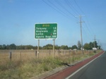
Distance Sign:
First RD along the route as you travel southbound along Surf Coast Highway at Grovedale. March 2008.
Image © Michael Gill
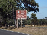
Supplemental Advance Directional Sign:
Southbound supplemental AD sign indicating distance to the start of Great Ocean Road. Photo taken along Surf Coast Highway at Mount Duneed. March 2008.
Image © Michael Gill
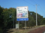
Tourism Themed Sign:
Southbound sign on the outskirts of Torquay on Surf Coast Hwy indicating the beginning of Great Ocean Rd. March 2008.
Image © Michael Gill
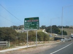
Distance Sign:
RD sign as you leave Torquay, near Spring Creek, March 2008.
Image © Michael Gill
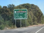
Distance Sign:
RD sign as you leave Anglesea's town centre, March 2008.
Image © Michael Gill
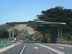
Timber Arch:
Timber arch and memorial plaques at Anglesea. March 2008.
Image © Michael Gill
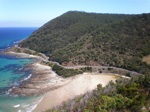
Great Ocean Road:
Image of the Great Ocean Road as it makes its way west in the Big Hill area, March 2008.
Image © Michael Gill
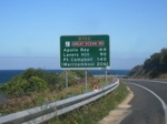
Distance Sign:
RD sign as you leave the town of Lorne, March 2008.
Image © Michael Gill
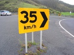
Chevron Sign:
Special chevron sign at Lorne featuring an advisory speed for the curve, October 2008.
Image © Darren Hodges
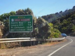
Distance Sign:
RD sign as you leave Wye River, March 2008.
Image © Michael Gill
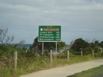
Distance Sign:
RD sign as you leave the town of Apollo Bay, March 2008.
Image © Michael Gill

Intersection Directional Signs:
ID signs facing Colac-Lavers Hill Rd and Lavers Hill-Cobden Rd at Lavers Hill, January 2017.
Image © Huang Milton Collection
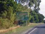
Distance Sign:
Reassurance directional sign as you leave Lavers Hill, March 2008.
Image © Michael Gill

Trailblazer:
Trailblazer facing Irvine St at Peterborough, January 2017.
Image © Huang Milton Collection

Drive On Left:
Reminder sign for visitors to drive on the left side of the road in Australia, Peterborough, January 2017.
Image © Huang Milton Collection
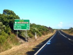
Reassurance Directional Sign:
Distance sign as you leave the Peterborough area. March 2008.
Image © Michael Gill
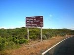
Tourist Reassurance Directional Sign:
RD sign at Peterborough showing distances to various tourist attractions / towns in the region. March 2008.
Image © Michael Gill
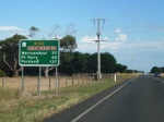
Distance Sign:
RD sign located in the Nirranda area, March 2008.
Image © Michael Gill

Intersection Directional Sign:
ID sign facing Ziegler Pde in Allansford, January 2017.
Image © Huang Milton Collection

Reassurance Directional Sign:
Distance sign at Allansford, January 2017.
Image © Huang Milton Collection

Welcome Sign:
Sign welcoming motorists to The Great Ocean Road, Allansford, January 2017.
Image © Huang Milton Collection

Advance Directional Sign:
AD sign at Allansford approaching Cobden-Warrnambool Rd (C167), January 2017.
Image © Huang Milton Collection

Intersection Directional Sign:
ID sign at the junction with Coden-Warrnambool Rd (C167) at Allansford, January 2017.
Image © Huang Milton Collection

Advance Directional Sign:
AD sign at Allansford approaching Cheese World, January 2017.
Image © Huang Milton Collection

Advance Directional Sign:
AD sign at Mepunga West approaching Childers Cove Rd, January 2017.
Image © Huang Milton Collection

Trailblazer:
B100 trailblazer at Mepunga West, January 2017.
Image © Huang Milton Collection

Advance Directional Sign:
AD sign at Nullawarre approaching Bartons Rd and Rowands Rd, January 2017.
Image © Huang Milton Collection

Bartons Road & Rowans Road:
Great Ocean Rd (B100) at the junction with Bartons Rd and Rowans Rd at Nullawarre, January 2017.
Image © Huang Milton Collection

Entering Nullawarre:
Great Ocean Rd (B100) as it enters the town of Nullawarre, January 2017.
Image © Huang Milton Collection

Advance Directional Sign:
AD sign at Nullawarre approaching Timboon-Nullawarre Rd (C163) and Henrys Sawmill Rd, January 2017.
Image © Huang Milton Collection

Timboon-Nullawarre Road & Henrys Sawmill Road:
Great Ocean Rd (B100) at Nullawarra at the junction with Timboon-Nullawarre Rd (C163) and Henrys Sawmill Rd, January 2017.
Image © Huang Milton Collection

Advance Directional Sign:
AD sign at Nirranda approaching Childers Cove Rd and Mathiesons Rd (Naylors Corner), January 2017.
Image © Huang Milton Collection

Naylors Corner:
Great Ocean Rd (B100) at Nirranda at Naylors Corner - the junction with Childers Cove Rd and Mathiesons Rd, January 2017.
Image © Huang Milton Collection

Advance Directional Sign:
AD sign at Nirranda approaching Boggy Creek Rd, January 2017.
Image © Huang Milton Collection

Reassurance Directional Sign:
Distance sign at Nirranda, January 2017.
Image © Huang Milton Collection

Advance Directional Sign:
AD sign at Nirranda South approaching Radfords Rd, January 2017.
Image © Huang Milton Collection

Advance Directional Sign:
AD sign at Peterborough approaching Dances Rd & Old Peterborough Rd, January 2017.
Image © Huang Milton Collection

Advance Directional Sign:
AD sign at Peterborough approaching Dances Rd & Old Peterborough Rd, January 2017.
Image © Huang Milton Collection

Dances Road & Old Peterborough Road:
Great Ocean Rd (B100) at the junction with Old Peterborough Rd and Dances Rd, January 2017. B100 turns right at this junction.
Image © Huang Milton Collection

Reassurance Directional Sign:
Distance sign at Peterborough, January 2017.
Image © Huang Milton Collection

Reassurance Directional Sign:
Distance sign at Peterborough with distances to tourist attractions, January 2017.
Image © Huang Milton Collection

Reassurance Directional Sign:
Distance sign at Peterborough, January 2017.
Image © Huang Milton Collection

Entering Peterborough:
Great Ocean Rd (B100) as it enters the town of Peterborough, January 2017.
Image © Huang Milton Collection

Reassurance Directional Sign:
Distance sign at Peterborough, January 2017.
Image © Huang Milton Collection

Reassurance Directional Sign:
Distance sign using travel times at Peterborough, January 2017.
Image © Huang Milton Collection

Advance Directional Sign:
AD sign at Peterborough approaching The Grotto Track, January 2017.
Image © Huang Milton Collection

Trailblazer:
B100 trailblazer at Port Campbell, January 2017.
Image © Huang Milton Collection

Advance Directional Sign:
AD sign at Port Campbell approaching Cobden-Port Campbell Rd (C164), January 2017.
Image © Huang Milton Collection

Intersection Directional Sign:
ID sign at the junction with Cobden-Port Campbell (C164) at Port Campbell, January 2017. B100 turns right at this junction.
Image © Huang Milton Collection

Advance Directional Sign:
AD sign approaching the roundabout with Morris St and Lords St in Port Campbell, January 2017.
Image © Huang Milton Collection

Advance Directional Sign:
AD sign approaching the roundabout with Cairns St in Port Campbell, January 2017.
Image © Huang Milton Collection

Reassurance Directional Sign:
Distance sign at Port Campbell, January 2017.
Image © Huang Milton Collection

Trailblazer:
B100 trailblazer at Port Campbell, January 2017.
Image © Huang Milton Collection

Approaching Princetown Road:
Great Ocean Rd (C166) at Princetown approaching Princetown Rd (C166), January 2017.
Image © Huang Milton Collection

Approaching Princetown Road:
Great Ocean Rd (C166) at Princetown approaching Princetown Rd (C166), January 2017.
Image © Huang Milton Collection

Approaching Princetown Road:
Great Ocean Rd (C166) at Princetown approaching Princetown Rd (C166), January 2017.
Image © Huang Milton Collection

Princetown Road:
Corner of Great Ocean Rd (B100) and Princetown Rd (C166) at Princetown, January 2017.
Image © Huang Milton Collection

Princetown Road:
Corner of Great Ocean Rd (B100) and Princetown Rd (C166) at Princetown, January 2017.
Image © Huang Milton Collection

Advance Directional Sign:
AD sign at Princetown approaching Old Post Office Rd, January 2017.
Image © Huang Milton Collection

Reassurance Directional Sign:
Distance sign at Princetown, January 2017.
Image © Huang Milton Collection

Advance Directional Sign:
AD sign in Lavers Hill, January 2017.
Image © Huang Milton Collection

Advance Directional Sign:
AD sign at Lavers Hill approaching Colac-Lavers Hill Rd and Lavers Hill-Cobden Rd, January 2017.
Image © Huang Milton Collection

Advance Directional Sign:
AD sign at Lavers Hill approaching Colac-Lavers Hill Rd and Lavers Hill-Cobden Rd, January 2017.
Image © Huang Milton Collection

Intersection Directional Sign:
ID sign at the junction with Colac-Lavers Hill Rd and Lavers Hill-Cobden Rd at Lavers Hill, January 2017.
Image © Huang Milton Collection

Intersection Directional Sign:
ID sign at the junction with Old Ocean Rd at Glenaire, January 2017.
Image © Huang Milton Collection

Advance Directional Sign:
AD sign at Hordern Vale approaching Hordern Vale Rd, January 2017.
Image © Huang Milton Collection

Advance Directional Sign:
AD sign at Cape Otway approaching Binns Rd, January 2017.
Image © Huang Milton Collection

Trailblazer:
B100 trailblazer at Cape Otway, January 2017.
Image © Huang Milton Collection

Advance Directional Sign:
AD sign at Apollo Bay approaching Nelson St, January 2017.
Image © Huang Milton Collection

Intersection Directional Sign:
ID sign at the junction with Nelson St in Apollo Bay, January 2017.
Image © Huang Milton Collection

Intersection Directional Sign:
ID sign at the junction with Nelson St in Apollo Bay, January 2017.
Image © Huang Milton Collection

Trailblazer:
B100 trailblazer in the Apollo Bay town centre, January 2017.
Image © Huang Milton Collection

Reassurance Directional Sign:
Distance sign in Apollo Bay, January 2017.
Image © Huang Milton Collection

Skenes Creek Road:
Corner of Great Ocean Rd (B100) and Skenes Creek Rd (C119) at Skenes Creek, January 2017.
Image © Huang Milton Collection

St George River:
View of the old bridge over the St George River at Lorne. October 2008.
Image © Darren Hodges

Advance Directional Sign:
AD sign at Belmont, approaching Corio-Waurn Ponds Rd (A10) and Torquay Rd at Belmont, July 2009.
Image © Tim Cole

Intersection Directional Sign:
ID sign at Belmont, at the junction with Corio-Waurn Ponds Rd (A10) and Torquay Rd at Belmont, July 2009.
Image © Tim Cole
1 Viseth Uch.
2 VIC Government, Road Management Plan, 2020-2021, 07 December 2020.
3 VIC Government, Visit Victoria, Great Ocean Road.
4 VIC Government, VicRoads.


