Statistics:
- Length:
- 206 km
- Termini:
- Eastern: Princes Hwy (A1) and Foster St (unnumbered), Sale
- Western: South Gippsland Hwy (M420) and Bass Hwy (M420), Lang Lang
- Suburbs, Towns & Localities Along Route:
- Lang Lang, Loch, Korumburra, Leongatha, Koonwarra, Meeniyan, Foster, Toora, Welshpool, Hedley, Alberton, Yarram, Woodside, Darriman, Giffard West, Stradbroke, Longford and Sale
Route Numbering:
- Current: A440
- Multiplexed with: B460 C453 C485
- Former: B440 180
- Road Authority Internal Classification: 1
- 6580
General Information:
A440 is a major route in south eastern Victoria, linking several towns in the South Gippsland Region. The route is mostly undivided and passes through bushland, rural, residential and commercial areas, and links with major routes to Melbourne and to the northeast of the state.
Multiplexes along the route include:
- B460, for 100 m, Leongatha
- C453, for 300 m, Woodside
- C485, for 300 m, Longford
History:
- 1840s: Punt operated over the confluence of the Latrobe River and Latrobe River on the outskirts of Sale. 2
- 1858: Completion of timber toll bridge to replace the punt at Sale. 2
- 1874: Toll for crossing timber bridge at Sale abolished. 2
- 1880: Construction begins on the Latrobe Swing Bridge (later to be renamed Sale Swing Bridge). 2
- 1883: The cast iron and wrought iron Latrobe Swing Bridge opened to traffic. 2
- 1972: The Country Roads Board permanently closed the swing operation of the Sale Swing Bridge. 2
- May 2002: The Sale Swing Bridge bypassed by a modern structure to the west. 2
- 19 February 2006: Restoration of the Sale Swing Bridge as a tourist attraction opened to the public. 2
Click or tap here for the former alignment between Lang Lang and Sale

Seaspray Road:
Sth Gippsland Hwy (A440) at the junction with Seaspray Rd (C496) at Longford, May 2011.
Image © Paul Rands

Advance Directional Sign:
AD sign at Longford approaching Rosedale-Longford Rd (C485) and Longford-Loch Sport Rd (C485), May 2011.
Image © Paul Rands

Longford-Loch Sport Road:
Corner of Sth Gippsland Hwy (A440) and Longford-Loch Sport Rd (C485) and Longford, May 2011.
Image © Paul Rands

Advance Directional Sign:
AD sign at Longford approaching Rosedale-Longford Rd (C485), May 2011.
Image © Paul Rands

Rosedale-Longford Road:
Corner of Sth Gippsland Hwy (A440) and Rosedale-Longford Rd (C485) at Longford, May 2011.
Image © Paul Rands

Latrobe River:
Sth Gippsland Hwy (A440) crossing Latrobe River at Stradbroke, May 2011.
Image © Paul Rands

Thomson River:
Sth Gippsland Hwy (A440) crossing Thomson River at Stradbroke, May 2011.
Image © Paul Rands

Entering Sale:
South Gippsland Hwy (A440) as it enters the town of Sale, May 2011.
Image © Paul Rands

Thomson River:
Sth Gippsland Hwy (A440) crossing Thomson River at Sale, May 2011.
Image © Paul Rands

Punt Lane:
Corner of Sth Gippsland Hwy (A440) and Punt Ln at Sale, May 2011. A440 veers right at this location.
Image © Paul Rands

Advance Directional Sign:
AD sign at Sale approaching Princes Hwy (A1) and Foster St, May 2011.
Image © Paul Rands

Reassurance Directional Sign:
Distance sign at Sale, May 2011.
Image © Paul Rands

Coxs Bridge:
Sth Gippsland Hwy (A440) crossing Coxs Br at Sale, May 2011.
Image © Paul Rands

Thomson River:
Sth Gippsland Hwy (A440) crossing Thomson River at Sale, May 2011.
Image © Paul Rands

Latrobe River:
Sth Gippsland Hwy (A440) crossing Latrobe River at Stradbroke, May 2011.
Image © Paul Rands

Advance Directional Sign:
AD sign at Longford approaching Rosedale-Longford Rd (C485), May 2011.
Image © Paul Rands

Longford-Loch Sport Road:
Corner of Sth Gippsland Hwy (A440) and Longford-Loch Sport Rd (C485) and Longford, May 2011.
Image © Paul Rands

Advance Directional Sign:
AD sign at Longford for Seaspray Rd (C496), May 2011.
Image © Paul Rands

Seaspray Road:
Sth Gippsland Hwy (A440) at the junction with Seaspray Rd (C496) at Longford, May 2011. A440 veers right at this location.
Image © Paul Rands

Reassurance Directional Sign:
Distance sign at Longford, May 2011.
Image © Paul Rands
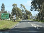
Advance Directional Sign:
AD sign approaching McDonald St (C455) at Meeniyan, August 2012.
Image © Rob Tilley
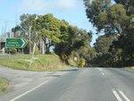
McDonald St:
Corner of South Gippsland Hwy (A440) and McDonald St, Meeniyan, August 2012.
Image © Rob Tilley
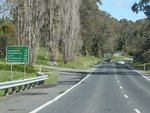
Reassurance Directional Sign:
Distance sign at Meeniyan, August 2012.
Image © Rob Tilley
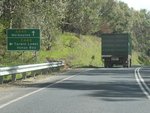
Advance Directional Sign:
AD sign at Tarwin approaching Tarwin Lower Rd (C443), August 2012.
Image © Rob Tilley
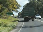
Intersection Directional Sign:
ID sign near the junction with Tarwin Lower Rd (C443) at Tarwin, August 2012.
Image © Rob Tilley
1 VIC Government, VicRoads, Road Management Plan 2020-2021, 07 December 2020.
2 ToMelbourne.com.au, The Sale Swing Bridge.


