Statistics:
- Length:
- 330 km
- Termini:
- Northern: Sunraysia Hwy (B220), Lascelles
- Southern: Madeira Packet Road (C194) and Greenmount Link (unnumbered), Portland
- Suburbs, Towns & Localities Along Route:
- Portland, Heywood, Hamilton, Cavendish, Horsham, Dooen, Warracknabeal, Beulah, Hopetoun and Lascelles
Route Numbering:
- Current: A200 A300
- Multiplexed with: A1 A8 B160 B240 C188 C234
- Former: 107
- Road Authority Internal Classification: 1
- 6620 (Portland to Bolwarra)
- 6500 (Bolwarra to Heywood)
- 6620 (Heywood to Horsham and Horsham to Lascelles)
- 6520 (Horsham)
General Information:
Located west of The Grampians, Henty Highway is a rural highway in country Victoria. It's primarily a north-south route, and consists of a mix of 2 laned country highway standard and 4 lane arterial road within some of the larger towns along the route.
Multiplexes along the route include:
- A1 (Princes Hwy), for 27 km, between Heywood and Portland North.
- A8 (Western Hwy), for 3 km, Horsham.
- B160 (Glenelg Hwy), for 3 km, Hamilton.
- B240 (Wimmera Hwy), for 10 km, between Horsham and Dooen.
- C188, for 500 m, Cavendish.
- C234 (Borung Hwy), for 1 km, Warracknabeal.
History:
- 1938: Henty Highway first declared, though at the time of declaration, it did not include the road through major townships. 2
- 1998: Henty Highway switched from SR107 to A200 / B200. 2
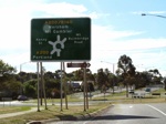
Advance Directional Sign:
AD sign on Mt Bainbridge Road in Hamilton approaching the roundabout with Mt Bainbridge Road, Kenny Street, and Glenelg Highway (B160), October 2006. This is where the B160 duplex starts.
Image © Rob Tilley
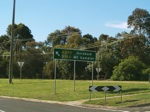
Intersection Directional Sign:
ID sign in Hamilton at the roundabout with Mt Bainbridge Road, Kenny Street, and Glenelg Highway (B160), October 2006.
Image © Rob Tilley
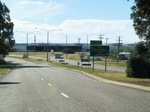
Advance Directional Sign:
Looking northwest near Young Street in Hamilton at the AD approaching the A200 / B160 split. October 2006.
Image © Rob Tilley
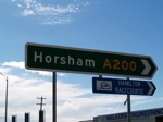
Intersection Directional Sign:
ID sign on the corner of Henty Hwy (A200) and Glenelg Hwy (B160) in Hamilton, October 2006.
Image © Rob Tilley
Distance Sign:
Northbound RD sign as you leave Hamilton, October 2006.
Image © Rob Tilley

Advance Directional Sign:
AD sign in Cavendish on Henty Hwy (A200) approaching the intersection with Barker St and Penshurst-Dunkeld Rd (Scott St). October 2006. This is where the C188 duplex begins.
Image © Rob Tilley

Barker & Scott Streets:
ID sign on the corner of Barker St and Scott St (C188) (Penshurst-Dunkeld Rd) in Cavendish, October 2006.
Image © Rob Tilley
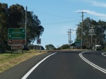
Advance Directional Sign:
AD sign in Cavendish approaching the intersection wth Natmiluk-Hamilton Rd (C188), October 2006. This intersection is where the duplex with C188 ends.
Image © Rob Tilley
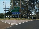
Natmiluk-Hamilton Rd Intersection:
Northbound on the corner of Henty Hwy (A200) and Natmiluk-Hamilton Rd (C188) in Cavendish, October 2006.
Image © Rob Tilley
Distance Sign:
Reassurance directional sign as you leave the town of Cavendish, October 2006.
Image © Rob Tilley

Distance Sign:
Northbound RD sign in Mooralla in the Grampians National Park, October 2006.
Image © Rob Tilley

Cambells Lane & Brimpaen-Laharum Road:
Henty Hwy in Brimpaen approaching the intersection with Campbells Ln & Brimpaen-Laharum Rd, October 2006.
Image © Rob Tilley

Distance Sign:
RD sign in Brimpaen after the intersection with Campbells Ln & Brimpaen-Laharum Rd, October 2006.
Image © Rob Tilley

Advance Directional Sign:
AD sign on Henty Hwy in Wonwondah approaching the intersection with Toolondo Road and Northeast Wonwondah Road, October 2006.
Image © Rob Tilley
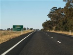
Distance Sign:
RD sign on Henty Hwy in Wonwondah after the intersection with Toolondo Road and Northeast Wonwondah Road, October 2006.
Image © Rob Tilley
.jpg)
Advance Directional Sign:
Northbound in Horsham approaching the intersection with Golf Course Road and Western Highway (A8), October 2006. This is where the A8 duplex begins.
Image © Rob Tilley
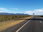
Mooralla Area:
Henty Hwy as it heads southbound through the Grampians National Park at Mooralla, with the Grampians mountain range on the left of shot. October 2006. The Grampians named in 1836 by Surveyor General of New South Wales Sir Thomas Mitchell after the Grampian Mountains in his native Scotland, but are also known by the name Gariwerd, from one of the local Aboriginal languages.
Image © Rob Tilley
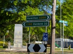
Barker & Scott Streets:
ID sign on the corner of Barker St and Scott St (C188) (Penshurst-Dunkeld Rd) in Cavendish, October 2006.
Image © Rob Tilley

Intersection Directional Sign:
ID sign in Hamilton at the roundabout with Mt Bainbridge Road, Kenny Street, and Glenelg Highway (B160), October 2006.
Image © Rob Tilley
1 VIC Government, VicRoads, Road Management Plan 2020-2021, 07 December 2020.
2 Viseth Uch.


.jpg)

