Road Photos & Information: Tasmania
Leith Road, Forth Road, Wilmot Road, Cradle Mountain Road and Belvoir Road (C132)
Statistics:
- Length:
- 95 km
- Termini:
- Northern: Bass Hwy (NH1) and Braddons Lookout Rd (C189), Leith
- Southern: Murchison Highway (A10), Guildford
- Suburbs, Towns & Localities Along Route:
- Leith, Forth, Lower Wilmot, Wilmot, Erriba, Moina, Middlesex and Guildford
Route Numbering:
- Current: C132
- Multiplexed with: B19
- Road Authority Internal Classification: 1
- A1552 (Forth)
- A2603 (Sheffield to Middlesex)
- A2674 (Middlesex to Guildford)
General Information:
C132 is a minor route in northern Tasmania. It follows the River Forth and Wilmot River for some distance and links a string of small towns and can even act as an alternative route from Devonport to Rosebery.
Multiplexes along the route include:
- B19, for 150 m, Forth.
Guildford to Leith

Intersection Directional Sign:
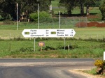
ID sign facing Back Road (C133) at Wilmot, October 2008. Click or tap here for a photo of this location by Peter Renshaw from April 2008.
Image © Peter Renshaw
1 TAS Government, Department of State Growth, State Roads, Asset Information, TRIPS: Tasmanian Road Information Positioning System, December 2020.