Statistics:
- Length:
- 99 km
- Termini:
- Northern: Davey St (A6) and Macquarie St (A6), Hobart
- Southern: Huon Hwy (A6) and Short St (unnumbered), Huonville
- Suburbs, Towns & Localities Along Route:
- Hobart, Sandy Bay, Taroona, Kingston, Margate, Snug, Kettering, Woodbridge, Flowerpot, Middleton, Verona Sands, Deep Bay, Cygnet and Huonville
Route Numbering:
- Current: B68
- Road Authority Internal Classification:1
- A0155 (Taroona to Huonville)
General Information:
Prior to the construction of the Southern Outlet (A6), the route that B68 follows once formed part of the main southbound route out of Hobart. The route traverses rugged terrain before connecting with towns which line the shores of the D'Entrecasteaux Channel and Huon River.
The Sandy Bay Road segment of B68 was first established as an early track in the colonial period, early in the nineteenth century. Early nineteenth century diagrams and art clearly show the track following along the western shore of the river heading south. It soon became a widened dirt road, before finally being bituminised in the early twentieth century. During the period in which trams and trolley buses were operated in Hobart, tramlines and trolley-bus lines ran the length of Sandy Bay Road from the city as far as Lower Sandy Bay.
Multiplexes along the route include:
History:
- 2003: Cycle lanes added to the Channel Highway between Taroona and Kingston. 2
- 2011: Kingston Bypass (Southern Outlet extension) opened to traffic.

Intersection Directional Sign:
ID sign on Sandy Bay Rd (B68), facing Gladstone St at Battery Point, July 2018.
Image © Paul Rands

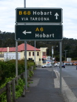
Advance Directional Sign:
AD sign on Southern Outlet (A6) at the Channel Hwy (B68) / Summerleas Rd interchange, Kingston, December 2011.
Image © Peter Renshaw

Reassurance Directional Sign:
Distance sign on Southern Outlet (B68) at Kingston, December 2011.
Image © Peter Renshaw

Advance Directional Sign:
AD sign on Southern Outlet (B68) approaching the roundabout with Channel Hwy (B68), Channel Hwy (unnumbered), Algona Rd and Huntingfield Av at Kingston, December 2011.
Image © Peter Renshaw

Advance Directional Sign:
AD sign on Channel Hwy (unnumbered) approaching the roundabout with Channel Hwy (B68), Southern Outlet (B68), Algona Rd and Huntingfield Av at Kingston, December 2011.
Image © Peter Renshaw

Advance Directional Sign:
AD sign on Huntingfield Av approaching the roundabout with Channel Hwy (unnumbered), Channel Hwy (B68), Southern Outlet (B68) and Algona Rd at Kingston, December 2011.
Image © Peter Renshaw

Advance Directional Sign:
AD sign on Channel Hwy (B68) approaching the roundabout with Southern Outlet (B68), Channel Hwy, Algona Rd and Huntingfield Av at Kingston, December 2011.
Image © Peter Renshaw

Intersection Directional Sign:
ID sign assembly at the roundabout with Channel Hwy, Algona Rd, Huntingfield Av, Channel Hwy (B68) and Southern Outlet at Kingston, December 2011.
Image © Peter Renshaw

Advance Directional Sign:
AD sign on Channel Hwy (unnumbered) approaching the roundabout with Southern Outlet (B68), Channel Hwy, Algona Rd and Huntingfield Av at Kingston, December 2011.
Image © Peter Renshaw

Intersection Directional Sign:
ID sign at the roundabout with Channel Hwy, Algona Rd, Huntingfield Av, Channel Hwy (B68) and Southern Outlet at Kingston, December 2011.
Image © Peter Renshaw

Reassurance Directional Sign:
Distance sign on Southern Outlet (B68) near Spring Farm Rd at Kingston, December 2011.
Image © Peter Renshaw

Kingston Bypass:
Looking northeast at the Spring Farm Rd overpass, Kingston, December 2011.
Image © Peter Renshaw

Advance Directional Sign:
AD sign at Kingston approaching Summerleas Rd interchange, Kingston, December 2011.
Image © Peter Renshaw

Summerleas Road:
Southern Outlet (B68) at the interchange with Summerleas Rd, Kingston, December 2011.
Image © Peter Renshaw

Intersection Directional Sign:
ID sign on the Summerleas Rd interchange, Kingston, December 2011.
Image © Peter Renshaw

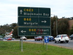
Black Advance Directional Sign:
Black AD sign assembly on Channel Hwy approaching Huon Hwy (unnumbered) and Beach Rd (C623), in Kingston. November 2007.
Image © Peter Renshaw

Black Advance Directional Sign:
Black AD sign assembly approaching the Channel Hwy and Beach Road from Huon Hwy, in Kingston. November 2007.
Image © Peter Renshaw

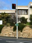
Old Style Signals:
Older style signals and target boards at the corner of Sandy Bay Rd (B68) and St Georges Tce at Battery Point, August 2006.
Image © Tim Cole
1 TAS Government, Department of State Growth, State Roads, Asset Information, TRIPS: Tasmanian Road Information Positioning System, December 2020.
2 TAS Government, DIER.


