Road Photos & Information: Tasmania
South Arm Highway, Rokeby Road and South Arm Road (B33)
Statistics:
- Length:
- 36 km
- Termini:
- Northern: Tasman Hwy (A3) and Flagstaff Gully Link, Mornington
- Southern: Pier Rd (unnumbered) and Spitfarm Rd (unnumbered) at O'Possum Bay
- Suburbs, Towns & Localities Along Route:
- Mornington, Howrah, Rokeby, Lauderdale, Sandford, South Arm and O'Possum Bay
Route Numbering:
- Current: B33
- Road Authority Internal Classification: 1
- A0498 (Mornington to Howrah)
- A2069 (Howrah to O'Possum Bay)
General Information:
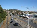
B33 is a major route linking Hobart with the South Arm Peninsula and consists of dual carriageway arterial route and undivided single carriageway. The route services mostly residential, commercial and rural zones, and some sections offer views of the River Derwent and Mortimer Bay.
History:
- 1989: The first stage of Bellerive Bypass (South Arm Hwy) was opened. It featured a dual carriageway. 2
- 2009: The final section of the Bellerive Bypass (South Arm Hwy) was completed in 2009, with the duplication of the South Arm Highway to Oceana Drive. 3
Mornington to O'Possum Bay
1 TAS Government, Department of State Growth, State Roads, Asset Information, TRIPS: Tasmanian Road Information Positioning System, December 2020.
2 TAS Government, Parliament of Tasmania, South Arm Highway, Shoreline Drive to Oceana Drive - Duplication, 2007.
3 TAS Government, Department of Infrastructure, Energy and Resources, Highway Upgrade page, 2007.
2 TAS Government, Parliament of Tasmania, South Arm Highway, Shoreline Drive to Oceana Drive - Duplication, 2007.
3 TAS Government, Department of Infrastructure, Energy and Resources, Highway Upgrade page, 2007.
