Road Photos & Information: Tasmania
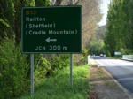
Latrobe Road, Kimberley Road and Railton Road (B13)
Statistics:
- Length:
- 34 km
- Termini:
- Northern: Mersey Main Rd (B19) and Frogmore Ln (B19), Latrobe
- Southern: Bass Hwy (NH1), Elizabeth Town
- Suburbs, Towns & Localities Along Route:
- Latrobe, Dulverton, Railton, Kimberley, Moltema and Elizabeth Town
Route Numbering:
- Current: B13
- Road Authority Internal Classification: 1
- A1251 (Latrobe to Railton)
General Information:
B13 is rural route in northern Tasmania, which runs somewhat in parallel with Bass Highway (NH1).
History:
- 2008: Replacement of the bridge on Railton Road over Loafer Creek. 2
Elizabeth Town to Latrobe
1 TAS Government, Department of State Growth, State Roads, Asset Information, TRIPS: Tasmanian Road Information Positioning System, December 2020.
2 Meander Valley Council, 2008/2009 Capital Works Programme, May 2008.
2 Meander Valley Council, 2008/2009 Capital Works Programme, May 2008.


