Road Photos & Information: Tasmania
Mole Creek Road and Liena Road (B12)
Statistics:
- Length:
- 39 km
- Termini:
- Eastern: Bass Highway (NH1), Deloraine
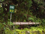
- Western: Liena Rd (unnumbered) and King Solomons Cave Car Park within Mole Creek Karst National Park, Liena
- Suburbs, Towns & Localities Along Route:
- Deloraine, Lemana Junction, Red Hills, Needles, Chudleigh, Mole Creek, Mayberry and Liena
Route Numbering:
- Current: B12
- Road Authority Internal Classification: 1
- A1374
General Information:
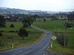
B12 is a spur road from the Bass Highway at Deloraine to King Solomons Cave near Liena. It serves the Mole Creek valley, an important dairying district, but also is an important tourist route with a number of attractions including the Trowunna Wildlife Park, Mole Creek and the Marakoopa and King Solomons Caves.
Deloraine to Liena
1 TAS Government, Department of State Growth, State Roads, Asset Information, TRIPS: Tasmanian Road Information Positioning System, December 2020.


