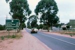
Road Photos & Information: South Australia
Mallee Highway (National Route 12) (Decommissioned)
Statistics:
- Length:
- 145 km
- Termini:
- Eastern: SA-VIC Border, Pinnaroo
- Western: Dukes Hwy (NH8), Tailem Bend
- Miscellaneous:
- Continues as B12 in Victoria
- Suburbs, Towns & Localities Along Route:
- Tailem Bend, Karoonda, Moorlands, Sherlock, Buccleuch, Peake, Jabuk, Geranium, Lameroo, Parilla and Pinnaroo
Route Numbering:
- Current: B12
- Former: 12
General Information:
National Route 12 is a two-lane rural route linking the grain-growing and sheep-farming Murray-Mallee area with Adelaide and country Victoria. National Route 12 also once traversed Victoria and New South Wales.
History:
- 1998: National Route 12 decommissioned and replaced by B12 with the introduction of alphanumeric route numbering.
