Statistics:
- Length:
- 716 km
- Termini:
- Eastern: Eyre Highway (NH1), Lincoln Gap (Port Augusta)
- Western: Eyre Highway (NH1), Ceduna
- Suburbs, Towns & Localities Along Route:
- Lincoln Gap, Whyalla, Cowell, Port Lincoln, Elliston, Streaky Bay and Ceduna
Route Numbering:
- Current: B100
- Former: 1
General Information:
Alternative National Route 1 was a collection of separate roads in different parts of South Australia that paralleled National Route 1 or offered a different route to the same destinations. ALT-NR1 on the Eyre Peninsula is rural highway standard, generally with 2 lanes in each direction, mostly servicing tourist areas and passing through mostly residential, rural and commercial zones.
The Lincoln Highway section links Port Lincoln and the east coast of the Eyre Peninsula with Port Augusta. Starting at the Eyre Highway, west of Port Augusta, the highway heads south to the industrial city of Whyalla. From Whyalla, the highway heads southwest, following the east coast of the Eyre Peninsula, eventually entering the prosperous fishing port of Port Lincoln. The Flinders Highway connects Port Lincoln with Ceduna, via the west coast of the Eyre Peninsula, travelling in a generally northwesterly direction. The highway is named after the explorer Matthew Flinders, who explored this area during the early 19th century.
History:
- Flinders Highway and Lincoln Highway:
- February 1978: An old road plough was placed beside the Flinders Highway to mark the sealing of the last stretch of highway between Talia and Streaky Bay, on Eyre Peninsula. The then Transport Minister, Mr Geoff Virgo, officially opened the Highway. 1
- 1998: ALT-NR1 decommissioned and replaced by B100 with the implementation of alphanumeric route numbering.
Post-1998 photos presented below are remnants, missed during alphanumeric conversion.

Distance Sign:
RD sign, located near Merrinthack Road in Fountain. June 2007.
Image © Darrin Smith
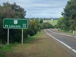
Distance Sign:
RD sign, Coomunga, June 2007.
Image © Darrin Smith

Advance Directional Sign:
AD sign approaching the junction with New West Road at Port Lincoln, June 2007.
Image © Darrin Smith

Proper Bay Road Intersection:
AD sign and intersection for Proper Bay Road at Port Lincoln, June 2007.
Image © Darrin Smith

Black Diagrammatic AD Sign:
Old black AD sign approaching the roundabout with Porter St Mortlock St (unnumbered), Le Brun St and Matilda St, June 2007.
Image © Darrin Smith

ID Sign Assembly:
Intersection directional signs facing traffic from Tel El Kebir Tce at Arno Bay, June 2007.
Image © Darrin Smith

Advance Directional Sign:
AD sign as you approach Arno Bay Road at Arno Bay, June 2007.
Image © Darrin Smith

ID Sign Assembly:
ID signs facing Arno Bay Road at Arno Bay, June 2007.
Image © Darrin Smith
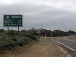
Distance Sign:
RD sign after the Arno Bay Road intersection at Arno Bay, June 2007.
Image © Darrin Smith

Advance Directional Sign:
AD sign as you approach the Middleback Road intersection at Iron Baron, June 2007.
Image © Darrin Smith
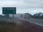
Distance Sign:
RD sign near the Middleback Rd junction at Iron Baron, June 2007.
Image © Darrin Smith

Playford Av Intersection:
Corner of Playford Av and Broadbent Tce in Whyalla, June 2007.
Image © Darrin Smith

NEW Intersection Directional Sign:
ID sign at the corner of Darling Tce, Horwood St and Whitehead St, Whyalla, April 2023.
Image © Terry Siva

Intersection Directional Sign:
ID sign, on the corner of Whitehead and Farrell Street Whyalla, June 2007.
Image © Darrin Smith

Advance Directional Sign:
NEW AD sign on Lincoln Hwy (Playford Av) approaching McBryde Tce, Whyalla, June 2007.
Image © Darrin Smith

Distance Sign:
RD sign located after the intersection with the Eyre Hwy at Lincoln Gap near Port Augusta. June 2007.
Image © Darrin Smith

AD Sign:
Approaching the Norrie Av intersection in Whyalla. June 2007.
Image © Darrin Smith

ID Sign:
Intersection directional sign facing Broadbent Tce traffic at Whyalla. Playford Av junction. June 2007.
Image © Darrin Smith

Reassurance Directional Sign:
Distance sign at Whyalla Stuart, December 2003.
Image © Michael Greenslade

Advance Directional Sign:
AD sign as you approach the Middleback Rd intersection at Iron Baron. June 2007.
Image © Darrin Smith
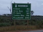
Reassurance Directional Sign:
Distance sign after the Middleback Rd intersection at Iron Baron. June 2007.
Image © Darrin Smith

Advance Directional Sign:
Approaching the intersection of Arno Bay Road at Arno Bay. June 2007.
Image © Darrin Smith
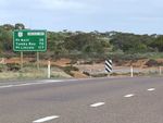
Distance Sign:
Reassurance directional sign as you leave the town of Arno Bay. June 2007.
Image © Darrin Smith

Advance Directional Sign:
Approaching the intersection with Sullivan Dr at Poonindie. June 2007.
Image © Darrin Smith

Old Reassurance Trailblazer:
Old reassurance shield mounted to a Stobie pole near New West Road in Port Lincoln. June 2007.
Image © Darrin Smith

Black Diagrammatic AD Sign:
Old black AD sign approaching the roundabout with Porter Street, June 2007.
Image © Darrin Smith

Distance Sign:
RD sign as you leave Port Lincoln area. June 2007.
Image © Darrin Smith

AD Sign:
Advance directional sign assembly for Proper Bay Road near Port Lincoln, June 2007.
Image © Darrin Smith

Advance Directional Sign:
AD sign for the New West intersection, Port Lincoln. June 2007.
Image © Darrin Smith

ID Sign Assembly:
ID sign and fingerboards facing New West Road at Port Lincoln, June 2007.
Image © Darrin Smith
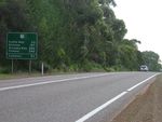
Distance Sign:
RD sign located after McFarlane Rd, Coomunga. June 2007.
Image © Darrin Smith

Advance Directional Sign:
AD signs on Venus Bay Rd at Venus Bay approaching Flinders Hwy, September 2015.
Image © Richard Wardle
1 SA Government, History Trust of South Australia.


