Statistics:
- Length:
- 18 km
- Termini:
- As A21 was a loop, there was no terminus.
- Suburbs, Towns & Localities Along Route:
- North Adelaide, Gilberton, Hackney, Kent Town, Adelaide, Dulwich, Wayville, Thebarton, Brompton and Medindie
Route Numbering:
- Current: R1
- Former: A21 1
- Road Authority Internal Classification: 1
- 05624 (Brompton to North Adelaide)
- 05648 (Thebarton to Brompton)
- 06143 (North Adelaide to Norwood)
- 06146 (Norwood to Dulwich)
- 06215 (Myrtle Bank to Clarence Gardens)
- 06185 (Dulwich to Wayville)
General Information:
A21 was designed to be a loop route or ring road around Adelaide and North Adelaide CBDs. It was a standard urban arterial road, with a small section, namely Park Road and Mann Road converted to one way sections.
The former National Route 1 section, is on the eastern side of the loop and takes in Robe Tce, Park Rd, Mann Rd, Hackney Rd, Dequetteville Tce and Fullerton Rd. This section was replaced in 1998 by A21, when Transport SA introduced alphanumeric numbering, causing a break in Highway 1 which circumnavigates Australia. The missing section was eventually renumbered to R1, thus re-linking Highway 1.
History:
- 1998: Introduction of the A21 route number.
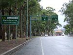
Advance Directional Signs:
Collection of AD signs on Greenhill Road (A21) in Adelaide, approaching the intersection with Fullarton Road. April 2007.
Image © Darrin Smith
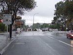
White Advance Directional Sign:
AD sign on Fullarton Road (non A21 section), Kent Town, approaching the intersection with Kensington Road, Dequetteville Terrace (A21), Fullarton Road (A21) and Wakefield Road, April 2007.
Image © Darrin Smith

White Advance Directional Sign:
AD sign on Kensington Road, Norwood South, approaching the intersection with Fullarton Road (A21), Dequetteville Terrace (A21) and Wakefield Road, April 2007.
Image © Darrin Smith
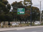
Advance Directional Sign:
AD sign on Port Rd (A21) approaching James Congdon Dr and George St, October 2012.
Image © Michael Greenslade

Advance Directional Sign:
AD sign on Grote St Adelaide, approaching Sir Donald Bradman Dr (A6) and West Tce (A21), October 2012.
Image © Michael Greenslade
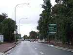
Advance Directional Sign:
Northbound AD sign on Fullarton Road in Eastwood, approaching Greenhill Road (A21). April 2007.
Image © Darrin Smith
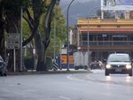
White Advance Directional Sign:
Old white AD sign approaching Wakefield Rd, Adelaide. April 2007.
Image © Darrin Smith

Advance Directional Signage:
AD sign on Dequetteville Tce, Adelaide approaching Rundle Rd and Rundle St. April 2007.
Image © Darrin Smith

Rundle Road / Rundle Street Intersection:
Corner of Rundle Road and Dequetteville Terrace at Kent Town, April 2007.
Image © Darrin Smith
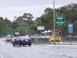
Advance Directional Sign:
Northbound AD sign approaching the River Torrens and Bundeys Road, Adelaide, April 2007.
Image © Darrin Smith
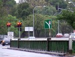
Advance Directional Sign:
Northbound supplemental AD sign approaching the Park Road / Mann Road split, Adelaide, April 2007.
Image © Darrin Smith
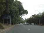
Black Supplementary AD Sign:
Heading northwest on Mann Road approaching Robe Terrace, North Adelaide, December 2007.
Image © Paul Rands

Advance Directional Sign:
AD sign approaching the corner of Mann Rd, Park Rd, Northcote Tce & Walkerville Tce, North Adelaide. January 2014. Click or tap here for a photo of this location by Paul Rands from December 2007, featuring a black sign.
Image © Michael Greenslade

Advance Directional Sign:
Westbound in North Adelaide on Fitzroy Terrace, approaching Main North Road (A1 and unnumbered). January 2014.
Image © Michael Greenslade
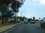
Advance Directional Sign:
AD sign on the unnumbered section of Main North Rd, approaching Main North Rd (A1), Fitzroy Tce (A21) and Robe Tce (A21), North Adelaide, December 2007.
Image © Paul Rands
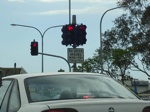
No Green Arrows Sign:
Sign indicating times when the signals don't show a green arrow, Main North Rd, at the junction with Main North Rd (A1), Fitzroy Tce (A21) and Robe Tce (A21), North Adelaide, December 2007.
Image © Paul Rands
1 SA Government, Location SA Map Viewer.


