Road Photos & Information: South Australia
Tod Highway (B90)
Statistics:
- Length:
- 177 km
- Termini:
- Northern: Eyre Hwy (A1), Kyancutta
- Southern: Flinders Highway (B100), Fountain
- Suburbs, Towns & Localities Along Route:
- Kyancutta, Warramboo, Ulyerra, Lock, Murdinga, Tooligie, Karkoo, Yeelanna, Cummins, Edillilie, Wanilla, Pearlah and Fountain
Route Numbering:
- Current: B90
- Road Authority Internal Classification: 1
- 02400
General Information:
The Tod Hwy acts as a connector from the Eyre Hwy (A1) to the halfway point of B100 on the Eyre Peninsula. It services a number of South Australia's small wheatbelt towns and localities and is of a rural road / rural highway standard. It is named after Robert Tod who explored the area in 1839. The route is used as a main access point for the grain terminals at Port Lincoln.
Fountain to Kyancutta
Kyancutta to Fountain
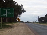
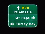
Advance Directional Sign:
Approaching the intersection with the Birdseye Highway (B91), which runs from Cowell to Elliston. June 2007. The highway is named after Mrs Sylvia Birdseye, a pioneer bus operator in SA. This was the first South Australian highway to be named after a woman. 2
Image © Darrin Smith
1 SA Government, Location SA Map Viewer.
2 SA Government, South Australian Parliament.
2 SA Government, South Australian Parliament.

