Statistics:
- Length:
- 202 km
- Termini:
- Northern: Old Sturt Highway (B201), Berri
- Southern: Princes Highway (South East Freeway) (M1), White Hill
- Suburbs, Towns & Localities Along Route:
- White Hill, Murray Bridge, Burdett, Chapman Bore, Karoonda, Lowaldie, Borrika, Sandalwood, Halidon, Mindarie, Wanbi, Alawoona, Veitch, Pata, Loxton and Berri
Route Numbering:
- Current: B55
- Former: 1 1
- Road Authority Internal Classification: 1
- 07015 (Loxton)
- 07018 (Berri to Loxton)
- 07500 (Loxton to Murray Bridge East)
- 07515 (Murray Bridge East to Murray Bridge)
- 07623 (Murray Bridge to White Hill)
General Information:
B55 is a connector route linking 2 somewhat important Murray River towns - Berri and Murray Bridge. It is rural road standard for the most part, and the section from Murray Bridge East to the Princes Hwy (South East Fwy) (M1) at Murray Bridge, is what was once part of the Princes Hwy.
History:
- 1879: Murray Bridge over the Murray River completed. 2
- 1922: Official proclamation of the Princes Highway. It was named in honour of Edward (1894-1972) Prince of Wales (who toured Australia for three months in 1920). 3
- 1953: The Princes Hwy section of the route was defined as the portion of the main road from Adelaide to Melbourne which extended as far as the Victorian border. 3
- 1972: South Eastern Fwy extended from Callington to Murray Bridge area.
- 1979: Swanport Bridge was completed, which was built five kilometres downstream from Murray Bridge, creating a bypass of the Murray Bridge town centre. 2
- 2006: Loxton Waikerie Council joined a push to have the B55 route named as Karoonda Highway. 4

Advance Directional Sign:
AD sign on Bookpurnong Rd (B55) at Berri approaching Crawford Tce and Foreman Rd, November 2016. Note the missing B55 route number.
Image © Paul Rands

Intersection Directional Sign:
ID sign on the roundabout with Crawford St and Foreman Rd in Berri, November 2016.
Image © Paul Rands

Intersection Directional Sign:
ID sign on the roundabout with Crawford St and Foreman Rd in Berri, November 2016.
Image © Paul Rands

Reassurance Directional Sign:
RD sign after the roundabout with Crawford St and Foreman Rd in Berri, November 2016.
Image © Paul Rands

Supplemental Advance Directional Sign:
Supplemental AD sign on Karoonda Hwy (B55) approaching Old Princes Hwy (B55 and unnumbered), December 2003.
Image © Michael Greenslade

Advance Directional Sign:
AD sign on Old Princes Hwy at Murray Bridge East, approaching Old Princes Hwy (B55) and Karoonda Hwy (B55), December 2003.
Image © Michael Greenslade
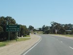
Supplemental Advance Directional Sign:
Supplemental AD sign on Old Princes Hwy at Murray Bridge East, approaching Old Princes Hwy (B55) and Karoonda Hwy (B55), October 2009.
Image © Paul Rands
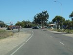
Mitchell Street Intersection:
Old Princes Hwy at the junction with Mitchell St at Murray Bridge East, October 2009.
Image © Paul Rands
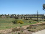
Murray Bridge:
Murray Bridge and floodplain, taken from a lookout at Murray Bridge East, October 2009.
Image © Paul Rands
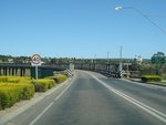
Approaching Murray Bridge:
Old Princes Hwy approaching Murray Bridge, October 2009.
Image © Paul Rands
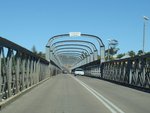
Murray Bridge:
The deck of Murray Bridge, October 2009.
Image © Paul Rands
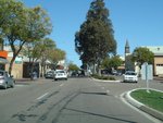
Murray Bridge CBD:
Looking southeast in Murray Bridge along Bridge Street, October 2009.
Image © Paul Rands
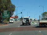
Advance Directional Sign:
AD sign on Bridge St in Murray Bridge, approaching the junction with Adelaide Rd (B55), Mannum and Swanport Roads, October 2009.
Image © Paul Rands
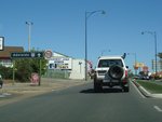
Black Intersection Directional Sign:
Black ID sign with remnant ALT-NR1 shield on Adelaide Rd (B55), just after the intersection with Standen St, Murray Bridge, October 2009.
Image © Paul Rands

Reassurance Directional Sign:
Distance sign on Adelaide Rd (B55) at Murray Bridge, December 2003. Note the incorrect M1 shield.
Image © Michael Greenslade

Advance Directional Sign:
AD sign at Murray Bridge approaching Old Princes Hwy (unnumbered) and the interchange with South Eastern Fwy (M1), December 2003.
Image © Michael Greenslade

Remnant ALT-NR1 Trailblazer:
Remnant ALT-NR1 trailblazer on Adelaide Rd (B55) approaching Old Princes Hwy at Murray Bridge, just before the South Eastern Fwy (M1) interchange.
Image © Peter Renshaw

White Hill Interchange:
View of the White Hill Interchange with South Eastern Fwy (M1) at Murray Bridge, December 2003. This is the southern terminus of B55.
Image © Michael Greenslade
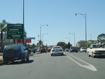
Advance Directional Sign:
AD sign on Adelaide Rd in Murray Bridge, approaching the junction with Mannum and Swanport Roads, October 2009.
Image © Paul Rands
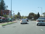
Supplemental Advance Directional Sign:
Supplemental AD sign on Adelaide Rd in Murray Bridge, approaching the junction with Bridge St (B55), Mannum and Swanport Roads, October 2009.
Image © Paul Rands
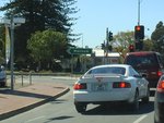
Mannum Rd / Swanport Rd Junction:
Signalised junction of Bridge St (B55), Adelaide Rd (B55), Mannum Rd and Swanport Rd in Murray Bridge, October 2009.
Image © Paul Rands

Murray Bridge:
The deck of Murray Bridge over the River Murray, December 2003.
Image © Michael Greenslade
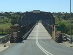
Murray Bridge:
The deck of Murray Bridge, October 2009.
Image © Paul Rands
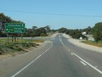
Advance Directional Sign:
AD sign on Old Princes Hwy (B55) at Murray Bridge East, approaching Old Princes Hwy (unnumbered) and Karoonda Hwy (B55), October 2009.
Image © Paul Rands

Reassurance Directional Sign:
Distance sign on Karoonda Hwy (B55) at Murray Bridge East, December 2003.
Image © Michael Greenslade

Intersection Directional Sign:
ID sign on the roundabout of Bookpurnong Rd (B55), Crawford Tce and Foreman Rd at Berri, November 2016.
Image © Paul Rands

Advance Directional Sign:
AD sign on Bookpurnong Rd (B55) at Berri approaching Old Sturt Hwy (B201), November 2016. Note the remnant ALT-NR20 shields.
Image © Paul Rands

Fingerboard:
Fingerboard facing Bookpurnong Rd (B55) on the intersection with Old Sturt Hwy (B201) at Berri, November 2016.
Image © Paul Rands
1 SA Government, Location SA Map Viewer.
2 The Rural City of Murray Bridge - About Murray Bridge.
3 SA Government, State Library of South Australia, Place Names of South Australia - P.
4 ABC News, Council backs highway name change, 22 June 2006.


