Statistics:

Length:
126 km
Termini:
Northern: South Eastern Freeway (M1), Mount Barker
Southern: Main South Road (B23), Delamere
Suburbs, Towns & Localities Along Route:
Delamere, Parawa, Willow Creek, Waitpinga, Encounter Bay, Victor Harbor, McCracken, Hayborough, Chiton, Port Elliot, Middleton, Goolwa Beach, Goolwa, Currency Creek, Tooperang, Finniss, Sandergrove, Strathalbyn, Gemmells, Bugle Ranges, Wistow and Mount Barker

Route Numbering:

Current: B37
Multiplexed with: A13
Road Authority Internal Classification: 1
04640 (Tooperang to Goolwa)
04646 (Mount Barker to Strathalbyn)
04649 (Strathalbyn)
04652 (Strathalbyn to Tooperang)
04688 (Goolwa to McCracken)
04760 (McCracken to Victor Harbor)
04793 (Victor Harbor)
47613 (Victor Harbor to Encounter Bay)
47615 (Encounter Bay to Delamere)

General Information:

B37 connects the Fleurieu Peninsula and Victor Harbor with the Adelaide Hills. It's mostly rural highway / rural road standard.

Multiplexes along the route include:
A13, for 3 km, between Hayborough and Victor Harbor.

History:

2006: Mill Road from the George Main Road roundabout to Prime Boulevard was upgraded. 2

Delamere to Mount Barker

image

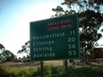
Reassurance Directional Sign:

Distance sign at Delamere, December 2003.

Image © Michael Greenslade

image

Intersection Directional Sign:

ID sign on the roundabout with Victoria St (B37), Bay Rd (B37), George Main Rd (unnumbered) and the entrance to Victor Harbor Oval at Victor Harbor, August 2020. B37 turns right at this location.

Image © Alexander Czarnecki

image

Advance Directional Sign:

AD sign on Victoria St (B37) at Victor Harbor, approaching Torrens St (A13 / B37), Victoria St (unnumbered) and Wills St, July 2020. B37 turns left at this intersection and the A13 duplex starts here.

Image © Alexander Czarnecki

image

Intersection Directional Sign:

ID sign pre-dating alphanumeric route numbering facing the unnumbered section of Victoria St in Victor Harbor at the junction with Victoria St (B37), Torrens St (A13 / B37) and Wills St, July 2020.

Image © Alexander Czarnecki

image

Advance Directional Sign:

AD sign at McCracken approaching Victor Harbour Rd (A13) and Port Elliot Rd (B37), July 2020. The A13 duplex ends at this intersection and B37 turns right at this location. Click or tap here for a photo of this location by Michael Greenslade from December 2003.

Image © Alexander Czarnecki

image

Reassurance Directional Sign:

Distance sign at Hayborough, December 2013. Click or tap here for a photo of this location by Michael Greenslade from December 2003.

Image © Michael Greenslade

image

Reassurance Directional Sign:

Distance sign at Currency Creek, December 2003.

Image © Michael Greenslade

image

Advance Directional Sign:

AD sign on South Tce (B37) at Strathalbyn approaching East Tce (B37), Langhorne Ck Rd (B45) and Callington Rd (unnumbered), September 2020.

Image © Alexander Czarnecki

image

Distance Sign:

RD sign on Adelaide Road as you leave the town of Strathalbyn. Note the placeholder for a route number. October 2004.

Image © Darrin Smith

image

Advance Directional Sign:

Faded AD sign at Mt Barker on Flaxley Rd approaching Wellington Rd (B37) and Adelaide Rd (B37), December 2003. This sign predates alphanumeric route numbering.

Image © Michael Greenslade

image

Freeway Green Advance Directional Sign:

Freeway green AD sign at Mt Barker on the Princes Hwy (M1) interchange, December 2003.

Image © Michael Greenslade

Mount Barker to Delamere

image

Advance Directional Sign:

AD sign on Old Princes Hwy at Littlehampton, approaching South Eastern Fwy (M1) and Adelaide Rd (B37), January 2014.

Image © Michael Greenslade

image

AD Sign:

Advance directional sign on Macclesfield Road (B33) approaching Adelaide Road (B37) and Wistow-Strathalbyn Road (B37) at Strathalbyn. October 2004.

Image © Darrin Smith

image

Advance Directional Sign:

AD sign on Callington Rd at Strathalbyn approaching Langhorne Ck Rd (B45), South Tce (B37) and East Tce (B37), September 2020.

Image © Alexander Czarnecki

image

AD Sign:

Advance directional sign approaching the junction with Adelaide-Goolwa Road at Finniss. October 2004.

Image © Darrin Smith

image

Advance Directional Sign:

AD sign at Currency Creek approaching Goolwa Rd, Narrows Rd and Airport Rd, December 2003.

Image © Michael Greenslade

image

Reassurance Directional Sign:

Distance sign at Currency Creek, December 2003.

Image © Michael Greenslade

image

Goolwa Terrace:

Corner of Fleurieu Way (Cadell St) and Goolwa Tce at Goolwa, December 2003.

Image © Michael Greenslade

image

Advance Directional Sign:

AD sign on Port Elliott Rd (B37) at Hayborough approaching Hindmarsh Rd (A13 / B37) and Adelaide Rd (A13), December 2013. Click or tap here for a photo of this location by Michael Greenslade from December 2003.

Image © Michael Greenslade

image

Intersection Directional Sign:

ID sign facing Torrens St (A13 / B37) in Victor Harbor at the junction with Victoria St (B37 and unnumbered) and Wills St, July 2020.

Image © Alexander Czarnecki

image

Advance Directional Sign:

AD sign on Victoria St at Victor Harbor, approaching Bay Rd (B37), George Main Rd (unnumbered) and the entrance to Victor Harbor Oval, August 2020. B37 turns left at this intersection.

Image © Alexander Czarnecki

image

Reassurance Directional Sign:

Distance sign on Bay Rd (B37) at Victor Harbor, August 2020.

Image © Alexander Czarnecki

image

Advance Directional Sign:

AD sign approaching the southern terminus of B37, Main South Rd (B23) at Delamere, December 2003.

Image © Michael Greenslade

1 SA Government, Location SA Map Viewer. 2 City of Victor Harbor.