Road Photos & Information: South Australia
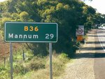
Mannum Road and Randell Road (B36)
Statistics:
- Length:
- 38 km
- Termini:
- Northern: Palmer-Murray Bridge Rd (B35), Palmer
- Southern: Reedy Ck Rd (B35), Murrary Bridge South
- Suburbs, Towns & Localities Along Route:
- Murray Bridge North, Pallamana, Mypolonga, Tepko, Caloote, Mannum, Frayville, Apamurra and Palmer
Route Numbering:
- Current: B36
- Road Authority Internal Classification: 1
- 07620 (Murray Bridge North to Mannum)
- 04489 (Mannum to Palmer)
General Information:
B36 is a rural route in the Mid Murray region of South Australia. It services a handful of localities and villages located north and northwest of Murray Bridge, which is one of the state's most rapidly growing areas.
History:
- 6 June 2005: Works commence on safety upgrades to the railway level crossing on Mannum Rd (B36) at Murray Bridge. The safety improvements adjacent to this level crossing included installation of a raised central median from the level crossing to Edmund Terrace, to prevent traffic turning right from Mannum Road, provision of a protected right-turn lane for motorists entering Swamp Road from Mannum Road and new line marking and signage. 2
- 2010: Safety improvements to Adelaide-Mannum Rd (B36) including safety barriers and delineation. 3
Murray Bridge to Palmer
1 SA Government, Location SA Map Viewer.
2 SA Government, Department of Transport, Energy and Infrastructure, News & Media Releases, Safety improvements to Mannum Road level crossing, Murray Bridge.
3 SA Government, Minister for Road Safety, News Release, $8 Million Injection for State Black Spot Program, 21 July 2010.
2 SA Government, Department of Transport, Energy and Infrastructure, News & Media Releases, Safety improvements to Mannum Road level crossing, Murray Bridge.
3 SA Government, Minister for Road Safety, News Release, $8 Million Injection for State Black Spot Program, 21 July 2010.

