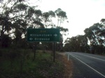
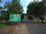
Road Photos & Information: South Australia
Cricks Mill Road, Williamstown Road, Melrose Street, Tungkillo Road, Randell Road, Adelaide Road, Reedy Creek Road, Mannum Road and Swanport Road (B35)
Statistics:
- Length:
- 65 km
- Termini:
- Northern: Warren Road (B34), Cromer
- Southern: Princes Hwy (A1) and South Eastern Fwy (M1), Murray Bridge
- Suburbs, Towns & Localities Along Route:
- Murray Bridge, Northern Heights, Murray Bridge North, Pallamana, Tepko, Palmer, Tungkillo, Mt Pleasant and Cromer
Route Numbering:
- Current: B35
- Multiplexed with: B10
- Road Authority Internal Classification: 1
- 04487 (Cromer to Mount Pleasant)
- 04480 (Mount Pleasant)
- 44803 (Mount Pleasant to Tungkillo)
- 04489 (Tungkillo to Palmer)
- 44806 (Palmer to Murray Bridge North
- 07506 (Murray Bridge)
- 07620 (Murray Bridge North to Murray Bridge)
General Information:
B35 acts as a connector route from the Adelaide Hills to the town of Murray Bridge. The route is mostly rural road / rural highway standard.
Multiplexes along the route include:
- B10, for 5 km, Mount Pleasant.
History:
- 1960s: The first reinforced concrete road bridge in South Australia was built at Reedy Creek, near Palmer. Made of beam and slab construction it was one of the first such bridges in Australia. 2
1 SA Government, Location SA Map Viewer.
2 SA Government, History Trust of South Australia.
2 SA Government, History Trust of South Australia.

