Road Photos & Information: South Australia
Mount Crawford Road, Warren Road, Shannon Street, William Street, Onkaparinga Valley Road, Mount Barker Road, Pine Avenue, Echunga Road, Aldgate-Strathalbyn Road, Battunga Road, Mawson Road, Dashwood Gully Road, Brookman Road, Victor Harbor Road and Pages Flat Road (B34)
Statistics:
- Length:
- 96 km
- Termini:
- Northern: South Para Road (B31), Williamstown
- Southern: Main South Road (B23), Myponga
- Suburbs, Towns & Localities Along Route:
- Williamstown, Cromer, Birdwood, Mount Torrens, Charleston, Woodside, Oakbank, Balhannah, Verdun, Hahndorf, Peachtown, Biggs Flat, Echunga, Meadows, Kuitpo, Dingabledinga, Hope Forest, Willunga Hill, Pages Flat and Myponga
Route Numbering:
- Current: B34
- Multiplexed with: A13 B10 B33
- Former: 1 1
- Road Authority Internal Classification: 1
- 04486 (Williamstown to Birdwood)
- 04489 (Birdwood)
- 04496 (Birdwood to Verdun)
- 04515 (Verdun to Hahndorf)
- 04516 (Hahndorf to Echunga)
- 04640 (Meadows)
- 04643 (Echunga to Meadows)
- 04664 (Meadows to Willunga Hill)
- 04760 (Willunga Hill)
- 04787 (Willunga Hill to Myponga)
General Information:
B34 is a route that connects the Adelaide Hills to the Fleurieu Peninsula area, south of Adelaide.
The Mount Barker Road section of B34 between Verdun and Hahndorf used to once be the Princes Hwy and used to be numbered NR1 until the 1970s.
The route is pretty much all rural highway / rural road standard and at times quite windy as it makes its way through the Adelaide Hills.
Multiplexes along the route include:
- A13 (Victor Harbor Road), for 3 km, Willunga.
- B10 (Torrens Valley Road), for 2 km, Birdwood.
- B33 (Adelaide Road), for 150 metres, Echunga.
History:
- 1938: Princes Highway named, covering what is now B34 from Verdun to Hahndorf.
- 1955: National Route 1 introduced to the Verdun to Hahndorf section.
- 1970s: Verdun to Hahndorf by-passed by South Eastern Fwy, revocation of NR1 between Verdun to Hahndorf, ALT-NR1 replacing it.
- 1998: Introduction of B34 route number.
- June 2003: Construction of a new $800 000 roundabout at the intersection of Mount Barker Road and the South Eastern Freeway interchange at Verdun. 2
- June 2005: Completion of a new roundabout at the junction of Onkaparinga Valley Road and Mount Barker Road, south of Verdun, near the South Eastern Fwy overpass, costing $570 000. 2
- 2014: Installation of two new wombat pedestrian crossings on Mount Barker Road, Hahndorf. Wombat crossings are a combination of raised platforms and striped crossings, where pedestrians have right of way and drivers are required to stop and give way. 3
- 2015: Installation of a roundabout at the corner of Woodside Road and Onkaparinga Valley Road. 4
- October 2015: Work commences on extending the sheltered right turn lane at the junction of Victor Harbor Road and Pages Flat Road. 5
- 2 May 2016: Work began on safety improvements at the Springton Road junction with Mt Crawford Road and Warren Road, Williamstown. The improvements included: construction of a sheltered right turn lane on Warren Road for motorists turning into Springton Road construction of a sheltered left turn lane on Mt Crawford Road for motorists turning into Springton Road realignment of the junction to improve visibility and safety for turning vehicles vegetation removal from the north-eastern side of the junction to improve sight distance installation of safety barriers, upgraded street lighting to improve visibility for motorists at night, and asphalt resurfacing of the junction. 6
Myponga to Williamstown
Williamstown to Myponga
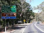
Advance Directional Sign:
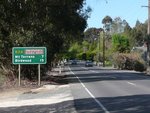
AD sign on Warren Road at Williamstown approaching Springton Road, December 2010. Click or tap here for a photo of this location by Darrin Smith from April 2007.
Image © Michael Greenslade
1 SA Government, Location SA Map Viewer.
2 SA Government, Transport SA.
3 SA Government, Department of Planning, Transport & Infrastructure, News, Hahndorf wombat crossings, 16 Sep 2014.
4 SA Government, Department of Planning, Transport & Infrastructure, News, Three major intersection upgrades in the Adelaide Hills 15 Sep 2014.
5 SA Government, Department of Planning, Transport & Infrastructure, News, Works begins on Noarlunga to Victor Harbor Road, 02 Oct 2015.
6 SA Government, Department of Planning, Transport & Infrastructure, News, Safety to be improved at the Springton Road junction with Mt Crawford Road and Warren Road, Williamstown, 02 May 2016.


