Road Photos & Information: South Australia
Main South Road, North Terrace, Howard Drive, Hog Bay Road, Playford Highway, Kohinoor Road and Telegraph Road (B23)
Statistics:
- Length:
- 153 km
- Termini:
- Northern: Main South Road (A13) & Victor Harbor Road (A13), Old Noarlunga
- Southern: Kingscote Terrace & Esplanade, Kingscote
- Suburbs, Towns & Localities Along Route:
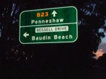
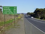
- Old Noarlunga, Seaford Rise, Aldinga, Myponga, Wattle Flat, Yankalilla, Normanville, Delamere, Cape Jervis, Penneshaw, Dudley East, American Beach, Baudin Beach, Dudley West, Browns Beach, Pelican Lagoon, Muston, Haines, Nepean Bay, Brownlow and Kingscote
Route Numbering:
- Current: B23
- Multiplexed with: 52
- Road Authority Internal Classification: 1
- 04763 (Old Noarlunga to Cape Jervis)
- 04880 (Cygnet River to Kingscote)
- 04883 (Penneshaw to Cygnet River)
General Information:
B23 is the main route from the mainland to Kangaroo Island. It is also the only numbered highway route on Kangaroo Island. The route forms part of the Fleurieu Way, a themed tourist route that traverses the Fleurieu Peninsula.
Cape Jervis, on the tip of the Fleurieu Peninsula is the point for daily car and passenger ferry services to Kangaroo Island. It's a 45 minute journey.
- Tourist Drive 52, for 35 km, between Main St, Yankalilla and Cape Jervis.
History:
- June 2006: Completion of a new southbound overtaking lane south of Maslin Beach Road 2
- May 2010: Upgrade works commenced at the Victor Harbor Road and Main South Road junction at Old Noarlunga. Works included installation of traffic lights including a pedestrian crossing at the Main South Road junction with Victor Harbor Road, widening South Road to three lanes each way between Main South Road and Seaford Road / Patapinda Road, introduction of additional lanes on the Victor Harbor Road and the Main South Road (south) approaches and improving the existing Main South Road / Seaford Road / Patapinda Road intersection. 3
- September 2010: Completion of upgrade works at the Victor Harbor Road and Main South Road junction at Old Noarlunga. 3
- 2015: Playford Highway / Hog Bay Road Intersection Improvemen. Work included realignment, channelised T-junction turn lane, traffic island and tree removal. 4
- August 2017: Work starts on upgrades along Main South Road between Old Coach Road and Malpas Road at Aldinga. Work included a new single lane roundabout at the junction of Port Road and Main South Road with a dedicated left slip lane for northbound vehicles from Port Road, U-turn facility north of Malpas Road, a three metre wide centre traffic median between Port Road and Malpas Road with central wire rope safety barrier, extension of the Main South Road left turning lane into Malpas Road, road widening and resurfacing, improved road lighting, road signage and line marking, plus removal of right turn movements in and out of Little Road at Main South Road, the addition of a shared user path crossing at Main South Road to facilitate cycling and walking between Aldinga and Willunga, pedestrian and cyclist access improvements at the roundabout, and removal of right turn movements out of Old Coach Road at Main South Road. A reduction of the speed limit was made from 100 km/h to 90 km/h between Seaford Heights and Little Road from 80 km/h to 70 km/h between Little Road and Hart Road. 5
- April 2018: Completion of upgrades between Old Coach Rd and Malpas Rd. 5
Kingscote (Kangaroo Island) to Old Noarlunga

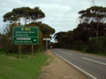
UPDATED Advance Directional Sign:
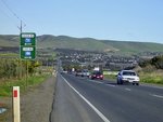
AD sign at Normanville approaching Main Rd, December 2021. Click or tap here for a photo of this location by December 2003 from Michael Greenslade.
Image © Michael Greenslade
Old Noarlunga to Kingscote (Kangaroo Island)

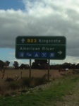
Advance Directional Sign:
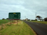
AD sign approaching Pages Flat Rd (B34) at Myponga, July 2014. Click or tap here for a photo of this location by Michael Greenslade, featuring black signs, from July 2004.
Image © Michael Greenslade
2 SA Government, Transport SA.
3 SA Government, Department of Planning, Transport & Infrastructure, Completed Projects, Victor Harbor Road / Main South Road Junction.
4 SA Government, Department of Planning, Transport & Infrastructure, News, Road safety improvements for 2014/15, 27 Aug 2014.
5 SA Government, Department of Planning, Transport & Infrastructure, Road Projects, Main South Road Upgrade - Old Coach Road To Malpas Road.
