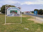
Road Photos & Information: South Australia
Riddoch Highway (A66 / B66)
Statistics:
- Length:
- 239 km
- Termini:
- Northern: Dukes Hwy (A8), Keith
- Southern: Sea Parade (unnumbered) at Port Macdonnell
- Suburbs, Towns & Localities Along Route:
- Keith, Padthaway, Keppoch, Naracoorte, Coonawarra, Penola, Tarpeena, Mount Gambier and Port MacDonnell
Route Numbering:
- Current: A66 B66
- Road Authority Internal Classification: 1
- 08000 (Keith to Mt Gambier
- 08832 (Mt Gambier to Port Macdonnell)
General Information:
The Riddoch Highway is a rural highway connecting the major inland town of Keith with South Australia's southeast coast. It also links the two main routes between Adelaide and Melbourne together as well.
The highway is named after Scottish born John Riddoch, who settled in the Penola area in 1861, and established the Penola Fruit Colony in 1890, renamed Coonawarra in 1897. The two-storey mansion Yallum Park was completed for John Riddoch in 1880 and many of the early buildings in the district were opened or had their foundation stones laid by him. He was a local Member of Parliament for many years. 2
History:
- 10 April 2015: Construction of the Penola Southern Bypass project was completed and open to traffic. This bypass, along with the completion of the Penola Northern Bypass will ultimately become part of Riddoch Highway. 3
- February 2018: Works commenced on upgrading the junction of Riddoch Hwy and Wandilo Forest Rd. Work included the provision of dedicated left and right turn lanes and pavement upgrades to accept B-double traffic. 4
Port MacDonnell to Keith
Keith to Port MacDonnell
1 SA Government, Location SA Map Viewer.
2 Wattle Range Council, Penola Local History and National Trust, Penola Local History Collection.
3 SA Government, Department of Planning, Transport & Infrastructure, Penola Northern Bypass Project.
4 SA Government, Department of Planning, Transport & Infrastructure, Works to start on Riddoch Highway - Wandilo Forest Road intersection upgrade, 27 Feb 2018.


