Road Photos & Information: South Australia
Anzac Highway (A5)
Statistics:
- Length:
- 7 km
- Termini:
- Eastern: Richmond Rd (R1) and Greenhill Rd (R1), Keswick
- Western: Anzac Road, Tapleys Hill Road (A15) and Brighton Road (A15), Glenelg East
- Suburbs, Towns & Localities Along Route:
- Keswick, Ashford, Everard Park, Kurralta Park, Plympton, Camden Park, Novar Gardens, and Glenelg East
Route Numbering:
- Current: A5
- Road Authority Internal Classification: 1
- 06212
General Information:
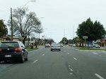
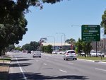
Anzac Highway is a major arterial route that links the Adelaide CBD with the west coast at Glenelg, as well as several inner western Adelaide suburbs. The route is divided with at least 2 lanes in each direction.
Multiplexes along the route include:
History:
- 1917: The first approach to rename the former Bay Road to Anzac Highway was made. 2
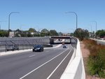
- July 2007: Construction begins on the interchange with South Road (A2) at Ashford. 3
- 15 March 2009: Announcement made that the interchange with South Road (A2) would be named Gallipoli Underpass. 2
- 27 March 2009: Traffic began using the brand new South Road / Anzac Highway Underpass, the 'Gallipoli Underpass' for the first time at 7 pm. 4
Keswick to Glenelg East
1 SA Government, Location SA Map Viewer.
2 Office of the Premier of South Australia, South Road underpass to be named in honor of Gallipoli, 15 March 2009.
3 Department of Transport, Energy & Transport, Gallipoli Underpass, Project Overview, 9 October 2009.
4 Department of Transport, Energy & Transport, Gallipoli Underpass, Project News, 9 October 2009.


