Road Photos & Information: South Australia
Barrier Highway (A32)
Gawler to Giles Corner
Former Alignment
Statistics:
- Length:
- 378 km (Gawler to Giles Corner: 40 km)
- Termini:
- Northern: NSW border, Cockburn
- Southern: Horrocks Hwy (B82), Giles Corner
- Miscellaneous:
- Continues as Barrier Hwy (A32) in New South Wales
- Suburbs, Towns & Localities Along Route:
- Gawler, Roseworthy, Tarlee and Giles Corner
Route Numbering:
- Current: B82
- Multiplexed with: B64
- Former: A32 32
- Road Authority Internal Classification: 1
- 03160
General Information:
A32 links Adelaide with the mid-north of South Australia. The highway also passes through the Nackara Range, and heads north-easterly direction eventually reaching Cockburn, which is located on both the SA/NSW border - split in half by the actual border. The highway is named after the Barrier Ranges which are located near Broken Hill.
- B64, for 7 km, Burra.
History:
- May 2005: Re-alignment of road surface curves and the sealing of the existing shoulder, between Templers and Tarlee. 2
- March 2008: Local council votes in favour to support the dual naming of the portion of Main North Road in the Clare & Gilbert Valleys Council area to include the name 'Horrocks Highway'. 3
- 2014: A32 replaced by B82 between Giles Corner and Gawler.
This page concentrates on the former alignment between Gawler and Giles Corner
Gawler to Giles Corner

Gawler Interchange:
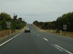
Horrocks Hwy (unnumbered) as it passes under the Gawler Bypass / Sturt Hwy (A20) and joins the A32 section of Horrocks Hwy, December 2007. Click or tap here for a photo of this location by Michael Greenslade from December 2003.
Image © Paul Rands

Advance Directional Sign:
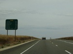
Northbound approaching Theile Highway (Gawler-Kapunda Road) (B81), Gawler, June 2008. Click or tap here for a photo of this location by Michael Greenslade from December 2003.
Image © Darrin Smith
 ">
">
UPDATED Distance Sign:
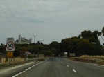
Northbound RD sign as A32 leaves the town of Tarlee, October 2012.
Image © Michael Greenslade

Horrocks Highway / Barrier Highway Split:
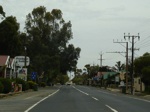
Northbound at the junction of Horrocks Hwy (B82) and Barrier Highway (A32). A32 veers right from here. Giles Corner, December 2007.
Giles Corner is named after Thomas Giles, son of William Giles, who was once general manager of the South Australia Company. Thomas Giles was a business partner of George Alexander Anstey, an early Yorke Peninsula pastoralist, remembered by the landmark Anstey Hill in the Adelaide Hills, overlooking Hope Valley.
Image © Paul Rands
2 SA Government, Transport SA.
3 Clare & Gilbert Valleys Council, Ordinary Meeting of Council, Minutes, 17 March 2008.


