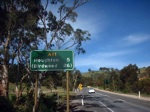
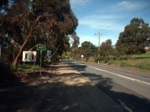
Road Photos & Information: South Australia
Lower North East Road, Payneham Road and North Terrace (A11)
Former Alignment
Statistics:
- Length:
- 22 km (Vista to Houghton: 6 km)
- Termini:
- Eastern: North East Rd (A10), Houghton
- Western: City Ring Road (R1) and Botanic Road, Hackney
- Suburbs, Towns & Localities Along Route:
- Houghton and Vista
Route Numbering:
- Current: A16
- Former: A11
- Road Authority Internal Classification: 1
- 05218 (Vista)
- 05232 (Vista to Houghton)
General Information:
A11 is a major arterial link between the Adelaide CBD and Adelaide's northeastern suburbs and travels through some of Adelaide's older suburbs.
This page concentrates on the former alignment between Vista and Houghton
Vista to Houghton
1 SA Government, Location SA Map Viewer.


