Statistics:
- Length:
- 92 km
- Termini:
- Northern: Barossa Valley Way (B19) and Old Mill Rd, Nuriootpa
- Southern: City Ring Route (R1) and Walkerville Tce at Gilberton
- Suburbs, Towns & Localities Along Route:
- Gilberton, Medindie, Walkerville, Collinswood, Klemzig, Hampstead Gardens, Greenacres, Hillcrest, Gillies Plains, Holden Hill, Valley View, Modbury, Ridgehaven, St Agnes, Tree Tree Gully, Houghton, Inglewood, Millbrook, Chain of Ponds, Gumeracha, Birdwood, Mt Pleasant, Springton, Taunton, Flaxman Valley, Mt McKenzie, Angaston and Nuriootpa
Route Numbering:
- Current: A10 B10
- Multiplexed with: B31 B34 B35 4
- Road Authority Internal Classification: 1
- 04387 (Nuriootpa to Angaston)
- 04480 (Angaston to Birdwood)
- 04489 (Birdwood to Menindie)
- 05615 (Menindie to Gilberton)
General Information:
A10 and B10 is a route linking the state capital of Adelaide with the Torrens Valley and the wine producing region of the Barossa Valley.
Multiplexes along the route include: 2
- B31, for 300 m, between Little Para Road and Tippet Road, Chain of Ponds.
- B34, for 1.5 km, between Warren Road and Mount Torrens Road, Birdwood.
- B35, for 700 m, between Cricks Mill Road and Tungkillo Road, Mt Pleasant.
- Tourist Drive 4, for 7 km, between Nuriootpa and Angaston.
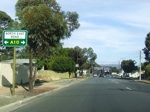
Advance Directional Sign:
Small AD sign approaching North East Road at Holden Hill, as you travel southeast on Wandana Av. April 2007.
Image © Darrin Smith
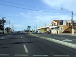
North East Road:
Travelling northeast on North East Road (A10) through Holden Hill. April 2007.
Image © Darrin Smith

Distance Sign:
Reassurance directional sign at Modbury. December 2003.
Image © Michael Greenslade
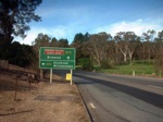
Advance Directional Sign:
AD sign approaching the intersection with Little Para Road at Chain of Ponds. October 2004.
Image © Darrin Smith
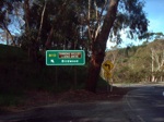
Reassurance Sign:
Reassurance sign as you pass through Gumeracha, October 2004.
Image © Darrin Smith

Advance Directional Sign:
AD sign as you approach Onkaparinga Valley Road (B34) at Birdwood, October 2004.
Image © Darrin Smith

ID Sign:
Intersection directional sign facing traffic on Onkaparinga Valley Road (B34) at Birdwood, October 2004.
Image © Darrin Smith

Advance Directional Sign:
AD sign located at Mt Pleasant approaching the Cricks Mill Rd (B35) intersection. October 2012. The B35 duplex starts here.
Image © Michael Greenslade

Advance Directional Sign:
Approaching Adelaide-Mannum Road intersection at Mt Pleasant. October 2004.
Image © Darrin Smith
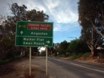
Advance Directional Sign:
Approaching Sedan Road at Mt Pleasant. October 2004.
Image © Darrin Smith
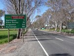
Distance Sign:
RD sign located at Mt Pleasant after the Sedan Road intersection. October 2012.
Image © Michael Greenslade
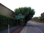
Advance Directional Sign:
Pre-route numbering AD sign with topknot added, approaching Murray Street in Angaston, October 2004.
Image © Darrin Smith

ID Sign Assembly:
Reassurance directional sign at Evanston, October 2004. This area is duplexed with Tourist Drive 4, the Barossa Scenic Heritage Drive.
Image © Darrin Smith

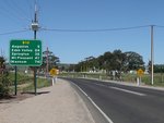
Black Advance Directional Sign Assembly:
Old black AD signs approaching the end of B10 (the intersection of Barossa Valley Way (B19) and Railway Terrace (B10)) at Nuriootpa, December 2003.
Image © Michael Greenslade
Reassurance Directional Sign:
Distance sign at Nuriootpa, October 2012.
Image © Michael Greenslade
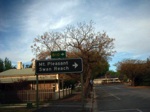
Black AD Sign:
Old black advance directional sign assembly approaching the Moculta Road intersection at Angaston. October 2004.
Image © Darrin Smith
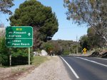
AD Sign:
Advance directional sign approaching Swan Reach Road at Angaston. October 2012.
Image © Michael Greenslade
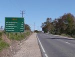
Reassurance Directional Sign:
Distance sign at Springton, October 2012.
Image © Michael Greenslade

Black AD Sign:
Black advance directional sign assembly at Angaston approaching Stott Hwy and Valley Rd, February 2011.
Image © Peter Renshaw
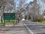
AD Sign:
Advance directional sign approaching junction with Angas Valley Road (Mt Pleasant-Sedan Road) at Mt Pleasant. October 2012.
Image © Michael Greenslade
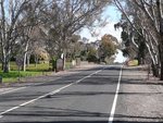
Entering Mount Pleasant:
Eden Valley Rd (B10) as it enters the town of Mt Pleasant, October 2012.
Image © Michael Greenslade

Advance Directional Sign Assembly:
AD sign assembly approaching Adelaide-Mannum Road (Tungkillo Road) (B35) at Mt Pleasant, October 2012. Click or tap here for a photo of this location by Darrin Smith from October 2004.
Image © Michael Greenslade

ID Sign:
ID sign assembly at the intersection with Adelaide-Mannum Road (B35) at Mt Pleasant. October 2004.
Image © Darrin Smith

Intersection Directional Sign:
ID sign facing Adelaide-Mannum Rd (B35) at Mt Pleasant, October 2004.
Image © Darrin Smith

Advance Directional Sign:
AD sign at Birdwood approaching Onkaparinga Valley Rd (B34), October 2012.
Image © Michael Greenslade

Black Intersection Directional Sign:
Black ID sign as at the junction with Onkaparinga Valley Road (B34) at Birdwood, February 2011.
Image © Peter Renshaw

Advance Directional Sign:
AD sign at Gumeracha, approaching Gorge Rd, July 2016.
Image © Michael Greenslade

South Para Road:
Corner of North East Rd (B10) and South Para Rd (B31) at Chain of Ponds, July 2016. The B31 duplex starts here.
Image © Michael Greenslade

Advance Directional Sign:
AD sign at Chain of Ponds approaching Tippett Rd (B31), July 2016.
Image © Michael Greenslade

Tippett Road:
Corner of North East Rd (B10) and Tippett Rd (B31) at Chain of Ponds, July 2016. The B31 duplex ends here.
Image © Michael Greenslade

Tippett Road:
Corner of North East Rd (B10) and Tippett Rd (B31) at Chain of Ponds, July 2016. The B31 duplex ends here.
Image © Michael Greenslade

Advance Directional Sign:
AD sign on North East Rd (A10) at Modbury, approaching Smart Rd and Wright Rd, July 2016.
Image © Michael Greenslade

Advance Directional Sign:
AD sign on North East Rd (A10) approaching Grand Junction Rd (A16), July 2016. Click or tap here for a photo of this location by Michael Greenslade from December 2003.
Image © Michael Greenslade

Advance Directional Sign:
AD sign at Manningham approaching Ascot Av (A17) and Taunton Rd (A17), July 2016.
Image © Michael Greenslade
1 SA Government, Location SA Map Viewer
2 Darrin Smith


