Statistics:
- Length:
- 52 km
- Termini:
- Eastern: Samford Rd (SR22) and Ferny Way (unnumbered), Ferny Grove
- Western: Wivenhoe-Somerset Rd (unnumbered), Dundas
- Miscellaneous:
- Route taken: Northbrook Pkwy, Mount Glorious Rd and Samford Rd
- Suburbs, Towns & Localities Along Route:
- Dundas, England Creek, Mount Glorious, Mount Nebo, Highvale, Samford Valley, Samford Village and Ferny Hills
Route Numbering:
- Current: 9
- Multiplexed with: 22 31
- Road Authority Internal Classification: 1
- 402 (Samford Village to Mt Glorious)
- 407 (Ferny Hills to Samford Village)
- 4023 (Mt Glorious to Lake Wivenhoe)
General Information:
Tourist Drive 9 is route servicing the outer northwestern suburbs of Brisbane and the Brisbane Valley. It's an undivided road servicing mostly residential, commercial and rural areas. It passes through Samford Conservation Park, Brisbane Forest Park, D'Aguilar National Park before terminating near Lake Wivenhoe, a man-made lake formed by Wivenhoe Dam which provides more than half of South East Queensland's drinking water. Tourism and Events Queensland, Destination Information, Lake Wivenhoe
Multiplexes along the route include:
- State Route 22, for 7 km between Ferny Hills and Samford Village.
- State Route 31, for 6 km, between Banks Creek and Mt Glorious.
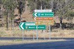
Intersection Directional Sign:
ID sign at the corner of Northbrook Pkwy (SR31 / TD9) and Wivenhoe-Somerset Dr at Lake Wivenhoe, August 2018.
Image © Rob Tilley

Start Tourist Drive 9:
Sign announcing the start of TD9 duplex at Ferny Hills, March 2012.
Image © Paul Rands

Trailblazer:
TD9 trailblazer at Ferny Hills, March 2012.
Image © Paul Rands
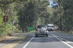
Trailblazer:
TD9 trailblazer at Ferny Hills, near Baden Ln, August 2018. Click or tap here for a photo of this location by Paul Rands from March 2012.
Image © Rob Tilley

Entering Samford Valley:
Samford Rd (SR22 / TD9) as it enters Samford Valley, March 2012.
Image © Paul Rands

Trailblazer:
TD9 trailblazer at Samford Valley, March 2012.
Image © Paul Rands

Advance Directional Sign:
AD sign on Samford Rd (SR22 / TD9) approaching the roundabout with Mt Glorious Rd (TD9) and Main St (SR22) at Samford Village, March 2012. TD9 continues straight at this intersection, and the SR22 duplex ends at this junction.
Image © Paul Rands

Intersection Directional Sign:
ID sign on the roundabout with Mt Glorious Rd (TD9) and Main St (SR22) at Samford Village, August 2018.
Image © Rob Tilley
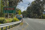
Reassurance Directional Sign:
Distance sign at Samford Village, August 2018.
Image © Rob Tilley
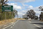
Advance Directional Sign:
AD sign at Samford Village approaching Wights Mountain Rd, August 2018.
Image © Rob Tilley
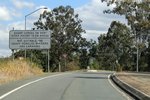
Steep Climb Sign:
Prohibition sign at Samford Village approaching the steep climb up Mt Glorious, August 2018.
Image © Rob Tilley
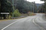
Entering Samford Valley:
Mt Glorious Rd (TD9) as it enters the town of Samford Valley, August 2018.
Image © Rob Tilley

Mount O'Reilly Road:
ID sign assembly at the junction with Mt O'Reilly Rd at Samford Valley, August 2018.
Image © Rob Tilley
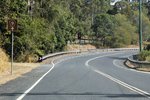
Trailblazer:
TD9 trailblazer at Samford Valley, August 2018.
Image © Rob Tilley
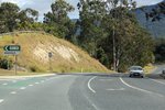
Entering Highvale:
Mt Glorious Rd (TD9) as it enters the town of Highvale, August 2018.
Image © Rob Tilley
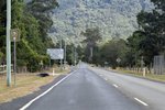
Trailblazer:
TD9 trailblazer at Highvale, August 2018.
Image © Rob Tilley
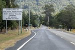
Steep Climb Sign:
Prohibition sign at Highvale approaching the steep climb up Mt Glorious, August 2018.
Image © Rob Tilley

South Pine River:
Mt Glorious Rd (TD9) as it crosses South Pine River at Banks Creek, August 2018.
Image © Rob Tilley
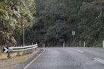
Trailblazer:
TD9 trailblazer at Banks Creek, August 2018.
Image © Rob Tilley
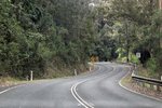
Banks Creek:
Mt Glorious Rd (TD9) as it winds its way through Banks Creek, August 2018.
Image © Rob Tilley

Advance Directional Sign:
AD sign at Mt Glorious approaching Mt Nebo Rd (SR31 / TD8), August 2018.
Image © Rob Tilley

Intersection Directional Sign:
ID sign at Mt Glorious at the Mt Nebo Rd (SR31 / TD8) junction, August 2018. The SR31 duplex begins at this location.
Image © Rob Tilley
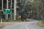
Reassurance Directional Sign:
Distance sign at Mt Glorious, August 2018.
Image © Rob Tilley
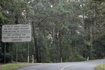
Steep Descent Sign:
Sign warning of steep descent and prohibition of certain vehicles, Mt Glorious, August 2018.
Image © Rob Tilley
Trailblazer:
TD9 trailblazer at Mt Glorious, August 2018.
Image © Rob Tilley
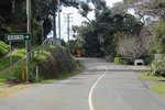
Mount Glorious:
Mt Glorious Rd (SR31 / TD9) as it passes through the town of Mt Glorious, August 2018.
Image © Rob Tilley
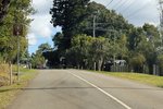
Trailblazer:
TD9 trailblazer at Mt Glorious, August 2018.
Image © Rob Tilley
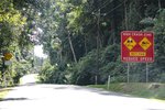
High Crash Zone:
High crash zone warning at Mt Glorious, August 2018.
Image © Rob Tilley
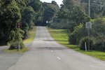
Trailblazer:
TD9 trailblazer at Mt Glorious, August 2018.
Image © Rob Tilley

Trailblazer:
TD9 trailblazer at Mt Glorious, August 2018.
Image © Rob Tilley
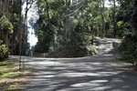
Trailblazer:
TD9 trailblazer near Alex Rd at Mt Glorious, August 2018.
Image © Rob Tilley
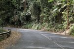
Trailblazer:
TD9 trailblazer at Mt Glorious, August 2018.
Image © Rob Tilley
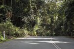
Trailblazer:
TD9 trailblazer at Mt Glorious, August 2018.
Image © Rob Tilley
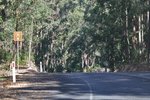
Trailblazer:
TD9 trailblazer at Mt Glorious, August 2018.
Image © Rob Tilley
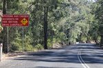
Crash Warning:
Crash warning sign on Northbrook Pkwy (TD9) at Dundas, August 2018.
Image © Rob Tilley
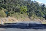
Trailblazer:
TD9 trailblazer at Dundas, August 2018.
Image © Rob Tilley
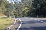
Trailblazer:
TD9 trailblazer at Dundas, August 2018.
Image © Rob Tilley
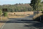
End Tourist Drive 9:
End TD9 sign at Lake Wivenhoe, approaching Wivenoe-Somerset Rd, August 2018.
Image © Rob Tilley
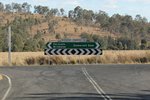
Intersection Directional Sign:
ID sign at Lake Wivenhoe facing Northbrook Pkwy (TD9), August 2018.
Image © Rob Tilley
1 QLD Government, Department of Transport & Main Roads, Queensland state-controlled roads and region maps, Metropolitan District, November 2022.


