Statistics:
- Length:
- 87 km
- Termini:
- Northern: Shafston Av (SR23), Lytton Rd (SR23) and Wellington Rd (unnumbered), East Brisbane
- Southern: Pacific Mwy (M1) and Hope Island Rd (SR4), Oxenford
- Miscellaneous:
- State Route 95 is marked on several maps between Upper Mount Gravatt and East Brisbane, but does not appear on signs after the junction with Kessells Rd and Mount Gravatt-Capalaba Rd (Metroad 2). Wellington Rd, Latrobe St, Elfin St, Lisburn St, Overend St form a one way pair between East Brisbane and Woolloongabba.
- Suburbs, Towns & Localities Along Route:
- Oxenford, Upper Coomera, Wongawallan, Tamborine Mountain, Tamborine, Logan Village, Buccan, Waterford, Waterford West, Loganlea, Kingston, Logan Central, Woodridge, Underwood, Eight Mile Plains, Upper Mount Gravatt, Mount Gravatt, Holland Park West, Holland Park, Greenslopes, Woolloongabba and East Brisbane
Route Numbering:
- Current: 95
- Multiplexed with: 22 50 94 8
- Former: 1 1
- Road Authority Internal Classification:
- U90 (Underwood to Upper Mount Gravatt) 1
- 204 (Waterford West to Underwood) 2
- 205 (Tamborine Mountain to Tamborine) 2
- 206 (Oxenford to Tamborine Mountain) 2
- 207 (Tamborine to Waterford West) 2
General Information:
State Route 95 is a major arterial route connecting the southern suburbs of Brisbane with the Gold Coast hinterland.
The route is a mix of single and dual carriageways and passes through residential, commercial, industrial and rural zones.
SR95 between Woolloongabba and Eight Mile Plains used to be part of the Pacific Highway and at various stages of its life numbered as National Route 1 and Alternative National Route 1. Until the opening of the South East Freeway (now Pacific Motorway), the Woolloongabba to Eight Mile Plains section formed part of the main coastal route between Brisbane, the Gold Coast and Sydney.
Multiplexes along the route include:
- State Route 22, for 500 m, Woolloongabba.
- State Route 50, for 300 m, Logan Central.
- State Route 94, for 3 km, between Loganlea and Waterford.
- Tourist Drive 8, for 23 km, between Oxenford and Tamborine Mountain.
History:
- 2009: Work begins of the realignment of Waterford-Tamborine Road between Plunkett Road and Tamborine Village. 3
- December 2009: Work starts on Brisbane–Beenleigh Road (Kingston Road), Loganlea Road, Tygum Road and Albert Street intersection in Waterford West. Work included new signage, signal upgrades and the construction of turn lanes. 4
- 2010: Completion of the upgrade of Waterford-Tamborine Road between Plunkett Road and Tamborine Village. 3
- December 2010: Tamborine–Oxenford Road upgrade begins between Welches Road and Kriedeman Road at Wongawallan. Works included construction of 2 bridges across Tamborine Creek and Wongawallan Creek, realignment of steep and curving sections, construction of dedicated turning lanes and street lighting at Welches Road, Currey Road and Kriedeman Road and the installation of over 400m of koala fencing. 5
- 27 June 2011: New bridge over Tamborine Creek at Wongawallan opens to traffic. 5
- October 2011: Completion of the Tamborine–Oxenford Road upgrade between Welches Road and Kriedeman Road at Wongawallan. 5

Advance Directional Sign:
AD sign on Tamborine Mtn Rd (SR95) at Tamborine Mountain approaching Geissmann Dr, July 2018.
Image © Rob Tilley

Intersection Directional Sign:
ID sign at the junction with Geissman Dr at Tamborine Mountain, July 2018.
Image © Rob Tilley

Advance Directional Sign:
AD sign approaching Cedar Creek Rd at Tamborine, July 2018.
Image © Rob Tilley

Trailblazer:
SR95 trailblazer on Tamborine Mtn Rd (SR95) at Tamborine, July 2018.
Image © Rob Tilley

Intersection Directional Sign:
ID sign at the junction with Beaudesert-Beenleigh Rd (SR92) at Tamborine, June 2010.
Image © Rob Tilley

Trailblazers:
SR95 trailblazers on Kingston Rd (SR95) near Rudge St and Moss St in Woodridge, March 2009.
Image © Rob Tilley

Trailblazer:
SR95 trailblazer on Kingston Rd (SR95) near Booran Dr in Woodridge, March 2009.
Image © Rob Tilley

Advance Directional Sign:
AD sign on Kingston Rd (SR95) approaching Compton Rd (SR30) at Woodridge, March 2009.
Image © Rob Tilley

Intersection Directional Sign:
ID sign on Kingston Rd (SR95) at the junction with Compton Rd (SR30) at Woodridge, March 2009.
Image © Rob Tilley

Intersection Directional Sign:
ID sign on Kingston Rd (SR95) at the junction with Compton Rd (SR30) at Woodridge, March 2009.
Image © Rob Tilley
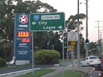
Advance Directional Sign:
AD sign on Padstow Rd (SR56) at Eight Mile Plains approaching Logan Rd (SR95), March 2006.
Image © Paul Rands

Advance Directional Sign:
AD sign on Logan Rd (SR95) at Upper Mount Gravatt approaching Kessels Rd (Metroad 2), October 2018. Note the incorrect route number.
Image © Dean Sherry

Intersection Directional Sign:
ID sign at the coner Logan Rd (SR95), Klumpp Rd and Dawson Rd at Upper Mt Gravatt, June 2009. Note the missing SR95 shield.
Image © Rob Tilley

Advance Directional Sign:
AD sign on O'Keefe St (SR22) approaching Logan Rd (SR95) at Woolloongabba (Stones Corner), March 2006. Note the missing SR95 shields.
Image © Paul Rands
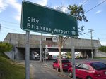
Reassurance Directional Sign:
Distance sign on Logan Rd (SR95) ad Woolloongabba, March 2006. Note the missing SR95 shield.
Image © Paul Rands
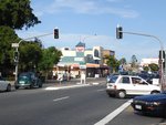
Stones Corner:
Logan Rd and Old Cleveland Road at Greenslopes (Stones Corner), March 2006.
Image © Paul Rands
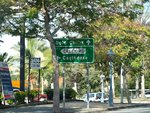
Advance Directional Sign:
AD sign on Logan Rd (SR95) at Mt Gravatt East approaching Creek Rd (SR20), June 2009. Note the missing route shields.
Image © Rob Tilley
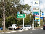
Creek Road:
Corner of Logan Rd (SR95) and Creek Rd (SR20) at Mt Gravatt East, June 2009.
Image © Rob Tilley
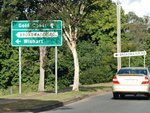
Advance Directional Sign:
AD sign on Logan Rd (SR95) approaching Broadwater Rd at Mt Gravatt East, June 2009.
Image © Rob Tilley
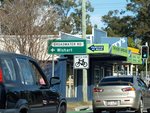
Broadwater Road:
Intersection directional sign at the Broadwater Rd junction in Mt Gravatt East, June 2009.
Image © Rob Tilley

Advance Directional Sign:
AD sign on Logan Rd (SR95) approaching Lumley St, Dawson Rd and Klumpp Rd, June 2009.
Image © Rob Tilley
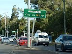
Klumpp Road & Dawson Road:
Logan Rd (SR95) at the junction with Klumpp Rd and Dawson Rd at Upper Mt Gravatt, June 2009.
Image © Rob Tilley
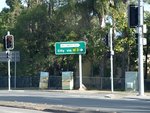
Klumpp Road & Dawson Road:
Logan Rd (SR95) at the junction with Klumpp Rd and Dawson Rd at Upper Mt Gravatt, June 2009.
Image © Rob Tilley

Advance Directional Sign:
AD sign on Logan Rd (SR95) approaching Mt Gravatt-Capalaba Rd & Kessels Rd (Metroad 2) at Upper Mt Gravatt, March 2019. Click or tap here for a photo of this location by Dean Sherry from October 2018. Click or tap here for a photo of this location by Rob Tilley from June 2009.
Image © Dean Sherry

Supplemental Advance Directional Sign:
Supplemental AD sign on Logan Rd (SR95) approaching Mt Gravatt-Capalaba Rd & Kessels Rd (Metroad 2) at Upper Mt Gravatt, June 2009.
Image © Rob Tilley

Overdimensional Route Traliblazer:
OD2 trailblazer approaching Mt Gravatt-Capalaba Rd & Kessels Rd (Metroad 2) at Upper Mt Gravatt, June 2009.
Image © Rob Tilley

Supplemental Advance Directional Sign:
Supplemental AD sign on Logan Rd (SR95) approaching Mt Gravatt-Capalaba Rd & Kessels Rd (Metroad 2) at Upper Mt Gravatt, June 2009.
Image © Rob Tilley

Intersection Directional Sign:
ID sign at the corner of Logan Rd (SR95), Kessels Rd (Metroad 2) and Mt Gravatt-Capalaba Rd (Metroad 2) at Upper Mt Gravatt, June 2009.
Image © Rob Tilley
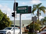
Intersection Directional Sign:
ID sign at the corner of Logan Rd (SR95), Kessels Rd (Metroad 2) and Mt Gravatt-Capalaba Rd (Metroad 2) at Upper Mt Gravatt, June 2009.
Image © Rob Tilley
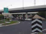
Pacific Motorway:
Logan Rd (SR95) at Eight Mile Plains at the interchange with Pacific Mwy (M3), March 2006.
Image © Paul Rands
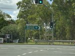
Intersection Directional Sign:
ID sign facing Wembley Rd (SR50) at Logan Central, March 2006.
Image © Paul Rands
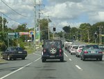
Distance Sign:
RD sign on Kingston Rd (SR95) at Logan Central after the Wembley Rd (SR50) junction, March 2006.
Image © Paul Rands
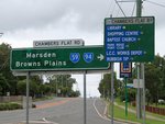
Intersection Directional Sign:
ID sign at the corner of Kingston Rd (SR95) and Chambers Flat Rd (SR94) at Loganlea, March 2010. The SR59 shield is in error. The SR94 duplex begins at this junction.
Image © Rob Tilley
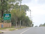
Reassurance Directional Sign:
RD sign on Kingston Rd (SR94 / SR95) at Loganlea, March 2010.
Image © Rob Tilley

Advance Directional Sign:
AD sign on Kingston Rd (SR94 / SR95) approaching Loganlea Rd & Tygum Rd at Waterford West, March 2010. SR94 / SR95 becomes Brisbane-Beenleigh Rd from this intersection.
Image © Rob Tilley

Advance Directional Sign:
AD sign approaching the SR94 section of Brisbane-Beenleigh Rd and Nerang St (SR95) at Waterford, March 2010.
Image © Rob Tilley

Intersection Directional Sign:
ID sign at the junction of Brisbane-Beenleigh Rd (SR94) and Nerang St (SR95) at Waterford, March 2010. The SR94 duplex ends here.
Image © Rob Tilley
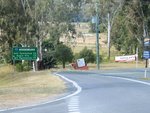
Distance Sign:
RD sign on Tamborine Mountain Rd (SR95) at Tamborine, June 2010.
Image © Rob Tilley
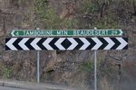
Fingerboard:
Fingerboard at Tamborine facing Cedar Creek Rd, June 2010.
Image © Rob Tilley
1 QLD Government, Department of Transport and Main Roads, Queensland state-controlled roads and region maps, South Coast Region, November 2022.
2 QLD Government, Department of Transport and Main Roads, Queensland state-controlled roads and region maps, Metropolitan Region, November 2022.
3 QLD Government, Department of Transport and Main Roads, Projects, Waterford-Tamborine Road upgrade.
4 QLD Government, Ministerial Media Statements, Work to ease congestion on busy Logan intersection starts, 2 December 2009.
5 QLD Government, Department of Transport and Main Roads, Projects, Tamborine–Oxenford Road upgrade fact sheet.


