Statistics:
- Length:
- 28 km
- Termini:
- Northern: Pacific Mwy (M1), Blackbird St (unnumbered), Brigade Dr (unnumbered) and Saverin Rd (unnumbered), Beenleigh
- Southern: Mundoolun Connection Rd (SR90) and Beaudesert-Beeleigh Rd (SR90), Tamborine
- Suburbs, Towns & Localities Along Route:
- Tamborine, Cedar Creek, Luscombe, Wolffdene, Bannockburn, Windaroo, Mount Warren Park and Beenleigh
Route Numbering:
- Current: 92
- Multiplexed with: 94
- Road Authority Internal Classification: 1
- 203 (Tamborine to Beenleigh)
- 208 (Beenleigh)
General Information:
State Route 92 is a mostly rural route (except at its northern end) and is a connector route between the Beenleigh and Beaudesert areas. The route services mostly rural, residential and commercial zones.
Multiplexes along the route include:
- State Route 94, for 800 m, Beenleigh.
Click or tap here for the former alignment between Tamborine and Beenleigh
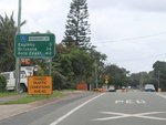
Distance Sign:
RD sign on Beenleigh Connection Rd (Boundary St) (SR92) at Beenleigh, March 2010.
Image © Rob Tilley

Advance Directional Sign:
AD sign on Boundary St (SR92) approaching Logan St and City Rd (SR92) in Beenleigh, March 2010. SR92 turns left at this junction.
Image © Rob Tilley

Intersection Directional Sign:
ID sign at the corner of Beenleigh Connection Rd (City Rd) (SR92), Beenleigh Connection Rd (Boundary St) (SR92) and Logan Rd in Beenleigh, March 2010.
Image © Rob Tilley

Advance Directional Sign:
AD sign approaching the interchange with Blackbird St, Saverin Rd and Pacific Mwy (M1) at Beenleigh, March 2010.
Image © Rob Tilley

Intersection Directional Sign:
ID sign at the interchange with Blackbird St, Brigade Dr, Saverin Rd and Pacific Mwy (M1) at Beenleigh, March 2010.
Image © Rob Tilley

Intersection Directional Sign:
ID sign at the interchange with Blackbird St, Brigade Dr, Saverin Rd and Pacific Mwy (M1) at Beenleigh, March 2010.
Image © Rob Tilley

Intersection Directional Sign:
ID sign at the interchange with Blackbird St, Brigade Dr, Saverin Rd and Pacific Mwy (M1) at Beenleigh, March 2010.
Image © Rob Tilley

Intersection Directional Sign:
ID sign at the interchange with Blackbird St, Brigade Dr, Saverin Rd and Pacific Mwy (M1) at Beenleigh, March 2010.
Image © Rob Tilley

Intersection Directional Sign:
ID sign at the roundabout on Beenleigh Connection Rd (Boundary St) (SR92) at the junction with Beenleigh Connection Rd (Hammel St) (SR92), Logan River Rd (SR94) and George St in Beenleigh, June 2010. This sign should say Hammel St, not Boundary St. The SR94 duplex begins at this junction.
Image © Rob Tilley

Intersection Directional Sign:
ID sign at the roundabout with Beenleigh Connection Rd (SR92), Logan River Rd (SR94) and George St in Beenleigh, June 2010.
Image © Rob Tilley
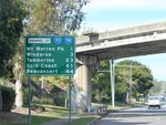
Distance Sign:
Reassurance directional sign on Beenleigh Connection Rd (Hammel St) (SR92 / SR94) at Beenleigh, June 2010.
Image © Rob Tilley

Advance Directional Sign:
AD sign on Beenleigh Connection Rd (Hammel St) (SR92 / SR94) approaching the roundabout with James St, Milne St (SR94) and Beenleigh-Beaudesert Rd (Lehmans Rd) (SR92) at Beenleigh, June 2010.
Image © Rob Tilley

Intersection Directional Sign:
ID sign at the roundabout with with Beenleigh Connection Rd (Hammel St) (SR92 / SR94), James St, Milne St (SR94) and Beenleigh-Beaudesert Rd (Lehmans Rd) (SR92) at Beenleigh, June 2010. The SR94 duplex ends at this junction.
Image © Rob Tilley

Intersection Directional Sign:
ID sign at the roundabout with with Hammel St (SR92 / SR94), James St, Milne St (SR94) and Beenleigh-Beaudesert Rd (Lehmans Rd) (SR92) at Beenleigh, June 2010. The SR94 duplex ends at this junction.
Image © Rob Tilley

Intersection Directional Sign:
ID sign at the roundabout with with Beenleigh Connection Rd (Hammel St) (SR92 / SR94), James St, Milne St (SR94) and Beenleigh-Beaudesert Rd (Lehmans Rd) (SR92) at Beenleigh, June 2010. The SR94 duplex ends at this junction.
Image © Rob Tilley
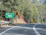
AD Sign:
Advance directional sign on Beenleigh-Beaudesert Rd (SR92) approaching Stanmore Rd at Wolffdene, June 2010.
Image © Rob Tilley
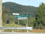
Intersection Directional Sign:
Fingerboard assembly at Wolffdene at the junction with Stanmore Rd, June 2010.
Image © Rob Tilley
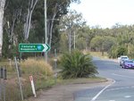
Leach Road:
Corner of Beenleigh-Beaudesert Rd (SR92) and Leach Rd at Tamborine, June 2010. SR92 turns right at this junction.
Image © Rob Tilley
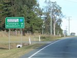
Distance Sign:
RD sign as SR92 leaves the town centre of Tamborine, June 2010.
Image © Rob Tilley

Advance Directional Sign:
AD sign at Tamborine approaching Mundoolun Connection Rd (SR90) and Beenleigh-Beaudesert Rd (SR90), June 2010.
Image © Rob Tilley

Supplemental Advance Directional Sign:
Supplemental AD sign at Tamborine approaching Mundoolun Connection Rd (SR90) and Beenleigh-Beaudesert Rd (SR90), June 2010.
Image © Rob Tilley

Mundoolun Connection Rd and Beenleigh-Beaudesert Rd:
End Start Route 92 trailblazer and intersection directional sign at Tamborine, June 2010.
Image © Rob Tilley
1 QLD Government, Department of Transport and Main Roads, Queensland state-controlled roads and region maps, South Coast Region, November 2022.


