Road Photos & Information: Queensland
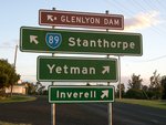
Inglewood-Texas Road and Stanthorpe-Texas Road (State Route 89)
Statistics:
- Length:
- 153 km
- Termini:
- Eastern: High Street (TD7), Stanthorpe
- Western: Cunningham Hwy (NR42) and Princess St (unnumbered), Inglewood
- Suburbs, Towns & Localities Along Route:
- Inglewood, Limevale, Texas, Silver Spur, Glenlyon, Pikes Creek, Pikedale, Greenlands and Stanthorpe
Route Numbering:
- Current: 89
- Multiplexed with: 8
- Road Authority Internal Classification: 1
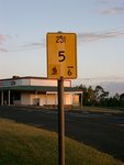
- 231 (Inglewood to Texas)
- 232 (Texas to Stanthorpe)
General Information:
State Route 89 is a rural route located in Queensland's granite belt, and acts as a connector for the small towns located between Cunningham and New England Highways.
The route passes through bushland, national parks and farming areas as well as a handful of small population towns. One of the towns on the route is Texas, which was named after a land claim in the 1850s which bore many similarities to one happening in Republic of Texas and Mexico in the United States at the same time. The original town was established on the river flats in 1875 but was relocated after the disastrous floods of 1890 and 1921.
Multiplexes along the route include:
- Tourist Drive 8, for 65 km, between Texas and Glenlyon.
History:
- 2006: The final stretch of state-controlled road in the Main Roads Border district, a 4 km section of Stanthorpe-Texas Rd at Black Springs 73 km west of Stanthorpe, bitumen sealed. Work also included widening to 7 metres, new signage and line markings. 2
- 2009: Concrete bridge replaces a timber one over Oaky Creek on Inglewood-Texas Rd at Limevale. 3
Inglewood to Stanthorpe
Stanthorpe to Inglewood
1 QLD Government, Department of Transport and Main Roads, Queensland state-controlled roads and region maps, Darling Downs Region, November 2022.
2 QLD Government, Ministerial Media Statements, Sealing a milestone for Border roads, 6 April 2006.
3 QLD Government, Ministerial Media Statements, New road approaches improve safety at Oaky Creek Bridge, 19 October 2009.
2 QLD Government, Ministerial Media Statements, Sealing a milestone for Border roads, 6 April 2006.
3 QLD Government, Ministerial Media Statements, New road approaches improve safety at Oaky Creek Bridge, 19 October 2009.
