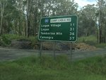
Road Photos & Information: Queensland
Camp Cable Road (State Route 88)
Statistics:
- Length:
- 7 km
- Termini:
- Eastern: Waterford-Tamborine Rd (SR95) and Yarrabilba Dr (unnumbered), Logan Village
- Western: Mt Lindesay Hwy (NR13), Jimboomba
- Suburbs, Towns & Localities Along Route:
- Jimboomba and Logan Village
Route Numbering:
- Current: 88
- Road Authority Internal Classification: 1
- 2071
General Information:
State Route 88 is a short link road in rural southeast Queensland. It is undivided and services mostly hobby farms and residential areas.
The road is named after a local American Army Camp from 1942. The camp was named in honour of Sergeant Gerald O'Cable, one of the 32nd Infantry Division, or Red Arrow Brigade, who was killed during transport along the southern Australian coast when torpedoed by a Japanese submarine. The Australians had camps at Maclean, Jimboomba, Tamborine and Canungra and the Americans at Jimboomba, Tamborine and Beaudesert. The Americans built Camp Cable Road to link with Jimboomba and the road between Tamborine and Logan Village was sealed. All culverts and bridges in the area were upgraded. It was a major camp housing men en route to service in the Pacific war and at one time had 35 000 soldiers stationed there. 2
History:
- 1942: Road construction by US armed forces. 2
Jimboomba to Logan Village
2 Logan City Council, About Logan, Suburbs, Yarrabilba.

