Statistics:
- Length:
- 84 km
- Termini:
- Eastern: Ferry St (SR57) and Alice St (unnumbered), Maryborough
- Western: Isis Hwy (SR52) and George St (unnumbered), Biggenden
- Suburbs, Towns & Localities Along Route:
- Biggenden, Boompa, Broowena, Hunters Hut, Yengarie, Oakhurst and Maryborough
Route Numbering:
- Current: 86
- Multiplexed with: 12
- Road Authority Internal Classification: 1
- 478 (Biggenden to Boompa and Brooweena To Maryborough)
- 479 (Boompa to Teebar)
- 487 (Teebar to Brooweena
General Information:
State Route 86 is a rural route that connects the towns of Maryborough and Biggenden, as well as several small communities in between.
The majority of the route is undivided, and services residential, commercial and rural areas. It also links the Isis Hwy (SR52) and Bruce Hwy (A1).
Multiplexes along the route include:
- Tourist Drive 12, for 700 m, Maryborough.

Advance Directional Sign:
AD sign approaching Bruce Hwy (A1) and Alice St (SR86) at Maryborough, December 2009.
Image © Rob Tilley

Bruce Highway:
intersection directional sign at the interchange with Bruce Hwy (A1) at Maryborough, December 2009.
Image © Rob Tilley

Bruce Highway:
intersection directional sign at the interchange with Bruce Hwy (A1) at Maryborough, December 2009.
Image © Rob Tilley
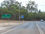
Distance Sign:
RD sign on Alice Street (SR86) in Maryborough, December 2009.
Image © Rob Tilley

Pallas Street:
Corner of Alice St (SR86) and Pallas St (TD12) in Maryborough, December 2009.
Image © Rob Tilley

Advance Directional Sign:
AD sign on Alice St (SR86) in Maryborough approaching the non-numbered section of Alice St and Ferry St (SR57), December 2009.
Image © Rob Tilley

Ferry Street:
The eastern terminus of SR86 in Maryborough, December 2009.
Image © Rob Tilley
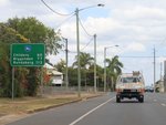
Distance Sign:
RD sign on Alice Street (SR86 / TD12) in Maryborough, December 2009.
Image © Rob Tilley

Advance Directional Sign:
AD sign near Cheapside St approaching Neptune St (TD12) at Maryborough, December 2009.
Image © Rob Tilley

Neptune Street:
Corner of Alice St (SR86) and Neptune St (TD12) in Maryborough, December 2009.
Image © Rob Tilley

Supplemental Advance Directional Sign:
Supplemental AD sign approaching Bruce Hwy (A1) and Alma St (SR86) at Maryborough, December 2009.
Image © Rob Tilley

Advance Directional Sign:
AD sign approaching Bruce Hwy (A1) and Alma St (SR86) at Maryborough, December 2009.
Image © Rob Tilley

Bruce Highway:
intersection directional sign at the interchange with Bruce Hwy (A1) at Maryborough, December 2009.
Image © Rob Tilley

Bruce Highway:
intersection directional sign at the interchange with Bruce Hwy (A1) at Maryborough, December 2009.
Image © Rob Tilley

Intersection Directional Sign:
ID sign at the junction with Hampton St in Maryborough West, December 2009. Note the local road name on the sign instead of Maryborough-Biggenden Rd.
Image © Rob Tilley
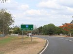
Distance Sign:
Reassurance directional sign as Maryborough-Biggenden Rd (SR85) leaves Maryborough West, December 2009.
Image © Rob Tilley
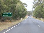
Advance Directional Sign:
AD sign at Oakhurst approaching Mungar Rd, December 2009.
Image © Rob Tilley
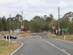
Mungar Road:
Corner of Maryborough-Biggenden Rd (SR86) and Mungar Rd at Oakhurst, December 2009.
Image © Rob Tilley
1 QLD Government, Department of Transport and Main Roads, Queensland state-controlled roads and region maps, Wide Bay / Burnett Region, November 2022.


