Road Photos & Information: Queensland
Maroochydore Road (State Route 8)
Former Alignment
Statistics:
- Length:
- 10 km
- Termini:
- Eastern: Beach Rd (SR6) and Ocean St, Maroochydore
- Western: Bruce Hwy (M1) and Nambour Connection Rd, Forest Glen
- Suburbs, Towns & Localities Along Route:
- Forest Glen, Kunda Park, Buderim and Maroochydore
Route Numbering:
- Current: 8
- Road Authority Internal Classification: 1
- 136
General Information:
State Route 8 is a divided arterial road linking the Sunshine Coast town of Maroochydore with the main coastal route, the Bruce Highway. The route passes through commercial, residential and industrial areas.
The route was longer than it is today, once extending from the Maroochydore business centre to Alexandra Headland and Tanawha.
History:
- 1962: Eudlo Creek to Maroochydore Road reconstruction including Eudlo Creek Bridge and channelised Maroochydore Road junction completed. 2
- December 1980: The 1.6 km duplication between Aerodrome Road and Alexandra Heads was completed. 3
- June 2006: Construction started on 3.8 km upgrade to four lanes and included the construction of bridges over Eudlo Creek, an overpass at Eudlo Flats Road and a grade-separated interchange at Sandalwood and Stark lanes. 4
- December 2006: Stage one of the upgrade to 4 lanes between Martins Creek and Pike Street was opened to traffic. 4
- 7 November 2008: Traffic switched onto the completed stretch of Maroochydore Road between Pike Street, Stark and Sandalwood lanes. 5
- 11 December 2008: Maroochydore Road upgrade officially commissioned between Bruce Hwy and Kunda Park. 4
- 4 September 2009: East Eudlo Creek Crossing on Maroochydore Road named the Hungerford Bridge. The Hungerford family is one of several that had contributed to the local community. 6
- 2011: Exit numbers introduced to Bruce Highway, with Exit 201 posted for the Nambour Connection Road / Maroochydore Road interchange. 7
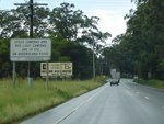
This page concentrates on the former alignment between Forest Glen and Maroochydore
Forest Glen to Maroochydore
Maroochydore to Forest Glen
1 QLD Government, Department of Transport and Main Roads, North Coast Road Region Map, November 2022.
2 Tyler Bullock.
3 QLD Government, Main Roads Annual Report 1980-1981.
4 QLD Government, Queensland Cabinet & Ministerial Directory, Media Statements, Maroochydore Road upgrade officially commissioned, 11 December 2008.
5 QLD Government, Queensland Cabinet & Ministerial Directory, Media Statements, Traffic switch for Maroochydore Road upgrade, 6 November 2008.
6 QLD Government, Queensland Cabinet & Ministerial Directory, Media Statements, New names revealed for north coast bridges, 4 September 2009.
7 QLD Government, Queensland Cabinet & Ministerial Directory, Media Statements, Exit numbering system expanded on the Bruce Highway, 9 February 2011.


