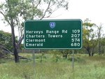
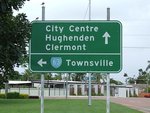
Road Photos & Information: Queensland
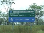
Gregory Developmental Road (State Route 63)
Statistics:
- Length:
- 259 km
- Termini:
- Eastern: Flinders Hwy (A6), Charters Towers (Richmond Hill)
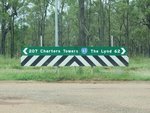
- Western: Kennedy Developmental Road (SR62), Conjuboy (The Lynd)
- Suburbs, Towns & Localities Along Route:
- Charters Towers, Breddan, Basalt, Greenvale and Conjuboy (The Lynd)
Route Numbering:
- Current: 63
- Road Authority Internal Classification: 1
- 98C
General Information:
State Route 63 is a route in Queensland's north. It passes through mainly bushland and rural areas, except in Charters Towers, where it services commercial and residential areas.
The road forms part of an important inland route between Cairns and Townsville that provides alternative access during post-cyclone flooding in North Queensland. 2
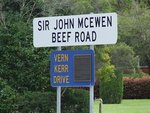
The route is also known as Lynd Highway and the Sir John McEwen Beef Road. The latter is named after a former Australian deputy prime minister. More than 40 years ago the late Sir John realised the importance of this road to the growth of the north Australian cattle industry. 3
History:
- 1960s and 70s: Paving of the road to single lane width. 4
- 1999: Construction of overtaking lanes between Charters Towers and Greenvale. 3
- 2009: Work begins to widen the route to 8 metres. 4
- 2010: Work begins on a heavy vehicle rest area, north of Charters Towers. 5
- 2011: Construction of 2 rest areas, located between Charters Towers and Hervey Range Road and another rest area between Hervey's Range Road and Greenvale. 6
Charters Towers to Conjuboy
Conjuboy to Charters Towers
1 QLD Government, Department of Transport and Main Roads, The State Road Network of Queensland, Far North District, November 2022.
2 QLD Government, Ministerial Media Statements, State Government continues to upgrade inland route to improve post-cyclone access in North Queensland, 5 December 2006.
3 North Queensland Register, Better roads boost Towers tourism, Lester Hanson, 12 November 1999.
4 QLD Government, Department of Transport and Main Roads, Projects, Gregory Developmental Road: widening works.
5 QLD Government, Ministerial Media Statements, Minister for Main Roads, New heavy vehicle rest area for the Gregory Developmental Road, 6 July 2010.
6 QLD Government, Ministerial Media Statements, Minister for Main Roads, Pull over driver, 2 December 2010.
