Road Photos & Information: Queensland
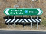
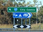
Dawson Highway (State Route 60) (Fitzroy Region)
Statistics:
- Length:
- 335 km
- Termini:
- Eastern: Hanson Rd (SR58), Glenlyon Rd (SR58) and Bramston St (unnumbered), Gladstone
- Western: Dawson Hwy (A7) and Carnarvon Hwy (A7), Rolleston
- Suburbs, Towns & Localities Along Route:
- Rolleston, Coorumbene, Arcadia Valley, Dromedary, Bauhinia, Rhydding, Oombabeer, Roundstone, Warnoah, Moura, Banana, Prospect, Biloela, Dakenba, Callide, Mount Murchison, Dumgree, Mount Alma, Wooderson, Calliope, Burua, Beecher, Kirkwood, Clinton, New Auckland, Kin Kora, West Gladstone and Gladstone
Route Numbering:
- Current: 60
- Multiplexed with: A3 A5
- Road Authority Internal Classification: 1
- 46A (Bileola to Gladstone)
- 46B (Banana to Biloela)
- 46C (Rolleston to Banana)
General Information:
The Dawson Highway (State Route 60) is a rural highway that connects Emerald with Gladstone.
The route passes though several small towns, rural areas and bushland. Some sections of the route are quite isolated.
Multiplexes along the route include:
- A3, for 1.5 km, Biloela.
- A5, for 500 m, Banana.
History:
- 2007: Widening works between Calliope and Banana. 2
- February 2007: Two solid concrete bridges have opened to traffic. The bridges across Zamia Creek and Clovernook Creek, east of Rolleston, replace old timber bridges. 3
- 23 January 2012: Calliope Range realignment open to traffic. 4
Rolleston to Gladstone
1 QLD Government, Department of Transport and Main Roads, Queensland state-controlled roads and region maps, Fitzroy Region, November 2022.
2 QLD Government, Ministerial Media Statements, Halfway milestone for fast tracked Dawson Highway, 21 March 2007.
3 QLD Government, Ministerial Media Statements, New bridges demonstrate progress on the Dawson Highway, 21 February 2007.
4 QLD Government, Ministerial Media Statements, $70m Calliope Range Realignment opens to traffic, 23 January 2012.
