Statistics:
- Length:
- 52 km
- Termini:
- Northern: Old Bruce Hwy (unnumbered, former A1) and Hughes Tce (unnumbered), Gympie
- Southern: Eumundi-Kenilworth Rd (TD22) and Maleny-Kenilworth Rd (TD22), Kenilworth
- Suburbs, Towns & Localities Along Route:
- Kenilworth, Imbil, Brooloo, Kandanga, Aramoor, Dagun, Gilldora, Calico Creek, Lagoon Pocket, Long Flat and Gympie
Route Numbering:
- Current: 51
- Multiplexed with: 42
- Road Authority Internal Classification: 1
- 481 (Kenilworth to Brooloo)
- 483 (Brooloo to Gympie)
General Information:
State Route 51 is a rural route connecting several small towns with the major centre of Gympie. The route is generally two lane undivided roadway and passes through mostly rural and residential areas.
Multiplexes along the route include:
- Tourist Drive 42, for 34 km, between Gympie and Imbil.
History:
- August 2008: Gympie-Brooloo Road, where it intersects with Tuchekoi Road, widened. 2
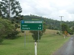
Reassurance Directional Sign:
RD sign on Kenilworth-Brooloo Rd (SR51) at Kenilworth, January 2009.
Image © Rob Tilley
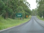
Advance Directional Sign:
AD sign approaching Parry St at Brooloo, January 2009.
Image © Rob Tilley
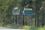
Intersection Directional Sign:
ID sign assembly at the corner of Parry St, Kenilworth-Booloo Rd (SR51) and Mary Valley Rd (SR51), November 2018. Click or tap here for a photo of this location by Rob Tilley from January 2009.
Image © Rob Tilley
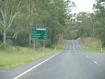
Reassurance Directional Sign:
RD sign on Mary Valley Rd (SR51) at Brooloo, January 2009.
Image © Rob Tilley

Advance Directional Sign:
AD sign approaching Yabba Ck Rd (TD42) at Imbil, January 2009. The TD42 duplex starts from this junction.
Image © Rob Tilley

Yabba Creek Road:
Corner of Mary Valley Rd (SR51) and Yabba Creek Rd (TD42) at Imbil, Novemer 2018. Click or tap here for a photo of this location by Rob Tilley from January 2009.
Image © Rob Tilley

Advance Directional Sign:
AD sign on Yabba Ck Rd (TD42) approaching Mary Valley Rd (SR51) at Imbil, January 2009.
Image © Rob Tilley

Intersection Directional Sign:
ID sign facing Yabba Ck Rd (TD42) at the junction with Mary Valley Rd (SR51) at Imbil, January 2009.
Image © Rob Tilley

Advance Directional Sign:
AD sign on Mary Valley Rd (SR51 / TD42) approaching Tuchekoi Rd (TD42) at Imbil, November 2018.
Image © Rob Tilley

Intersection Directional Sign:
ID sign at the junction with Tuchekoi Rd (TD42) at Imbil, November 2018.
Image © Rob Tilley
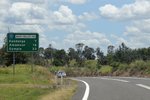
Reassurance Directional Sign:
Distance sign at Imbil, November 2018.
Image © Rob Tilley
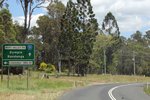
Advance Directional Sign:
AD sign at Kandanga approaching Kandanga-Imbil Rd, November 2018.
Image © Rob Tilley
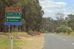
Advance Directional Sign:
AD sign at Kandanga, approaching Kandanga Creek Rd, November 2018.
Image © Rob Tilley
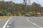
Kandanga Creek Road:
ID sign at the junction with Kandanga Ck Rd at Kandanga, November 2018.
Image © Rob Tilley
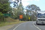
Advance Directional Sign:
AD sign at Dagun approaching Dagun Rd, November 2018.
Image © Rob Tilley
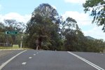
Intersection Directional Sign:
ID sign at the Dagun Rd intersection, Dagun, November 2018.
Image © Rob Tilley

Advance Directional Sign:
AD sign at Gympie, approaching Bruce Hwy (A1) interchange, November 2018.
Image © Rob Tilley

Bruce Highway:
Mary Valley Rd (SR51 / TD42) at the Bruce Hwy (A1) interchange at Gympie. This is the terminus for both SR51 and TD42.
Image © Rob Tilley
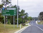
Reassurance Directional Sign:
Distance sign on Mary Valley Rd (SR51 / TD42) at Gympie, October 2014.
Image © Michael Greenslade
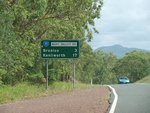
Reassurance Directional Sign:
RD sign on Mary Valley Rd (SR51) at Imbil, January 2009.
Image © Rob Tilley

Advance Directional Sign:
AD sign approaching Parry St at Brooloo, January 2009.
Image © Rob Tilley
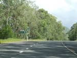
Intersection Directional Sign:
ID sign assembly at the corner of Parry St, Kenilworth-Booloo Rd (SR51) and Mary Valley Rd (SR51), January 2009.
Image © Rob Tilley

Reassurance Directional Sign:
RD sign on Kenilworth-Booloo Rd (SR51) at Brooloo, January 2009.
Image © Rob Tilley

Intersection Directional Sign:
ID sign facing Kenilworth-Brooloo Rd (SR51) approaching Eumundi-Kenilworth Rd (TD22) and Maleny-Kenilworth Rd (TD22) at Kenilworth, January 2009.
Image © Rob Tilley
1 QLD Government, Department of Transport and Main Roads, Queensland state-controlled roads and region maps, Wide Bay / Burnett Region, November 2022.
2 QLD Government, Ministerial Media Statements, $2 million overhaul for busy Tuchekoi Road, 15 August 2008.


