Road Photos & Information: Queensland
Wembley Road, Kingston Road and Paradise Road (State Route 50)
Statistics:
- Length:
- 10 km
- Termini:
- Eastern: Chatswood Rd (unnumbered) and Achilles Dr (unnumberd), Daisy Hill
- Western: Browns Plains Rd (SR94) and Wembley Rd (unnumbered), Browns Plains
- Suburbs, Towns & Localities Along Route:
- Browns Plains, Berrinba, Logan Central and Slacks Creek
Route Numbering:
- Current: 50
- Multiplexed with: 95
- Road Authority Internal Classification: 1
- 200
General Information:
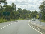
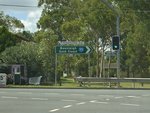
State Route 50 is a short suburban route linking Logan Central with both the Pacific Mwy (M1) and Logan Mwy (M6). It's a mix of divided and undivided road passing through mostly commercial and residential areas.
Multiplexes along the route include:
- State Route 95, for 300 m, Logan Central.
History:
- December 2011: Northbound off ramp from Pacific Mwy (M1) permanently closed as part of Pacific Mwy (M1) upgrade. 2
Browns Plains to Daisy Hill
1 QLD Government, Department of Transport and Main Roads, Metropolitan Road Region Map, November 2022.
2 QLD Government, Department of Transport and Main Roads, Pacific Motorway Upgrade Project, Springwood (south) to Daisy Hill, Construction update, November / December 2011.
2 QLD Government, Department of Transport and Main Roads, Pacific Motorway Upgrade Project, Springwood (south) to Daisy Hill, Construction update, November / December 2011.


