Road Photos & Information: Queensland
Beenleigh-Redland Bay Road, Serpentine Creek Road, Cleveland-Redland Bay Road, Bloomfield Street, Russell Street and Waterloo Street (State Route 47)
Statistics:
- Length:
- 32 km
- Termini:
- Northern: Shore St West (SR22), Cleveland
- Southern: Pacific Mwy (M1) and Pacific Mwy Service Rd (unnumbered), Loganholme
- Suburbs, Towns & Localities Along Route:
- Loganholme, Cornubia, Carbrook, Redland Bay, Victoria Point, Thornlands and Cleveland
Route Numbering:
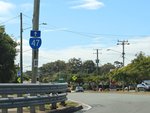
- Current: 47
- Multiplexed with: 21
- Road Authority Internal Classification: 1
- 108 (Loganholme to Redland Bay)
- 109 (Redland Bay to Cleveland)
General Information:
State Route 47 is an arterial route in Brisbane's bayside. It connects coastal suburbs with Pacific Motorway (M1) the main route between Brisbane and the New South Wales border.
Within Cleveland and Loganholme, the route is divided, but beyond that it's undivided for most of its remainder. The route passes through residential, commercial, rural and bushland areas.
Multiplexes along the route include:
- State Route 21, for 400 m, Victoria Point.
- Southern Moreton Bay Tourist Drive, for 6 km, between Victoria Point and Cleveland.
History:
- 2007: Intersection upgrade at Benfer Rd and Clay Gully Rd. Works included the addition of turning lanes and a staged pedestrian crossing. 2
- October 2010: Work begins on intersection upgrades at Cleveland-Redland Bay Road, Ziegenfusz Road, Dinwoodie Road and Beveridge Road. Works included duplication of Cleveland-Redland Bay Road between Ziegenfusz Road and Dinwoodie Road from two lanes to four, and signal installation at Ziegenfusz Road and Dinwoodie Road intersections, duplication from two lanes to four and signal installation at the Cleveland-Redland Bay Road and Beveridge Road intersection, construction of a bridge spanning 13 metres between Ziegenfusz Road and Dinwoodie Road, incorporating provision for fauna, the upgrade of six existing bus stops to include bus pull in bays and the provision cycle lanes and pedestrian footpaths. 3
- August 2011: Beveridge Road intersection improvements completed. 3
- 2012: Finalisation on work started in October 2010. 3
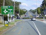
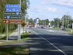
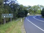
Loganholme to Cleveland

Reassurance Directional Sign:
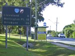
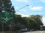
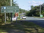
Distance sign on Beenleigh-Redland Bay Rd (SR47) at Carbrook, October 2016. Click or tap here for a photo of this location by Michael Greenslade from May 2006.
Image © Dean Sherry
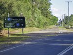
Cleveland to Loganholme
1 QLD Government, Department of Transport and Main Roads, Queensland state-controlled roads and region maps, Metropolitan Region, November 2022.
2 QLD Government, Ministerial Media Statements, Minister for Transport and Main Roads, Victoria Point Intersection upgrade, 27 March 2007.
3 QLD Government, Department of Transport and Redlands Corridor Program Section C: Cleveland Redland Bay Road Upgrade.
2 QLD Government, Ministerial Media Statements, Minister for Transport and Main Roads, Victoria Point Intersection upgrade, 27 March 2007.
3 QLD Government, Department of Transport and Redlands Corridor Program Section C: Cleveland Redland Bay Road Upgrade.


