Statistics:
- Length:
- 15 km
- Termini:
- Eastern: Wellington Point Reserve, Wellington Point
- Western: Wynnum Rd (SR23) and Belmont Rd (unnumbered), Tingalpa
- Suburbs, Towns & Localities Along Route:
- Tingalpa, Manly West, Wakerley, Ransome, Thorneside, Birkdale and Wellington Point
Route Numbering:
- Current: 43
- Multiplexed with: 30
- Road Authority Internal Classification: 1
- 1122 (Birkdale to Wellington Point)
General Information:
State Route 43 is a suburban route in Brisbane's bayside, linking coastal suburbs with the Gateway Motorway (M1).
The route passes through suburban, semi-rural and commercial areas and is a mix of divided and undivided road.
Multiplexes along the route include:
- State Route 30, for 700 m, Wakerley.
- Southern Moreton Bay Tourist Drive, for 6 km, Wakerley.

Intersection Directional Sign:
ID sign at the Quarry Rd / Birkdale Rd (SR54) roundabout at Birkdale, July 2011.
Image © Rob Tilley

Advance Directional sign:
AD sign on Rickertt Rd at Ransome approaching Green Camp Rd (SR43), July 2011. The SR44 shield is an error, and this is where the SR30 duplex begins here.
Image © Rob Tilley

Supplemental Advance Directional Sign:
Supplemental AD sign on Rickertt Rd at Wakerley approaching Green Camp Rd (SR43), July 2011.
Image © Rob Tilley

Green Camp Road:
Corner of Rickertt Rd (SR43) and Green Camp Rd (SR30 / SR43) at Wakerley, July 2011.
Image © Rob Tilley
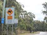
Trailblazers:
Trailblazers along Green Camp Rd at Wakerley, July 2011.
Image © Rob Tilley
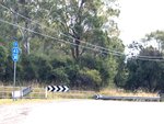
Trailblazers:
Trailblazers along Green Camp Rd, just before the Tilley Rd intersection at Wakerley, July 2011.
Image © Rob Tilley
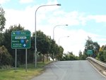
Advance Directional Sign:
AD sign on Green Camp Rd (SR30 / SR 43) approaching Manly Rd (SR30) at Wakerley, July 2011.
Image © Rob Tilley
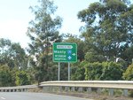
Advance Directional Sign:
AD sign on Green Camp Rd (SR30 / SR 43) approaching Manly Rd (SR30) at Wakerley, July 2011.
Image © Rob Tilley

Advance Directional Sign:
AD sign on Manly Rd (SR43) approaching Wynnum Rd (SR23) and Belmont Rd at Tingalpa, July 2011.
Image © Rob Tilley

Intersection Directional Sign:
ID sign at the junction with Wynnum Rd (SR23) and Belmont Rd at Tingalpa, July 2011.
Image © Rob Tilley

Intersection Directional Sign:
ID sign at the junction with Wynnum Rd (SR23) and Belmont Rd at Tingalpa, July 2011.
Image © Rob Tilley
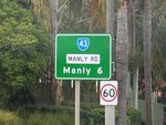
Distance Sign:
RD sign on Manly Rd (SR43) at Tingalpa, July 2011.
Image © Rob Tilley

Intersection Directional Sign:
ID sign at the Rickertt Rd junction at Wakerley, July 2011.
Image © Rob Tilley
1 QLD Government, Department of Transport and Main Roads, Queensland state-controlled roads and region maps, Metropolitan Region, November 2022.


