Statistics:
- Length:
- 13 km
- Termini:
- Northern: Annerley Rd (SR10) and Stanley St (SR10), Woolloongabba
- Southern: Logan Rd (SR95) and Macgregor St (unnumbered), Upper Mount Gravatt
- Suburbs, Towns & Localities Along Route:
- Upper Mount Gravatt, Mount Gravatt East, Holland Park, Coorparoo, East Brisbane and Woolloongabba
Route Numbering:
- Current: 41
- Former: 20 22
General Information:
State Route 41 is an arterial route south of the river in the Brisbane metropolitan area, linking Brisbane CBD with suburbs to the southeast.
The route is a mix of divided and undivided road, and passes through mostly residential and commercial areas.
Prior to the introduction of Metroads in the 1990s, SR20 used to duplex SR41 between Mt Gravatt-Capalaba Rd and Creek Rd. And there also used to be an SR22 duplex between South and East Brisbane.
History:
- 1993: State Route 20 discontinued on Newnham Road. 1
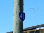
Trailblazer:
SR41 trailblazer on Newnham Rd near Dawson Rd at Upper Mt Gravatt, October 2010.
Image © Rob Tilley
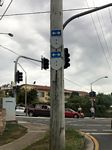
Trailblazer Assembly:
SR41 trailblazer and remnant SR20 trailblazer facing Broadwater Rd at the junction with Newnham Rd (SR41) at Upper Mt Gravatt, March 2019.
Image © Dean Sherry

Advance Directional Sign:
AD sign on Newnham Rd (SR41) at Mt Gravatt East approaching Creek Rd (SR20), October 2010.
Image © Rob Tilley

Intersection Directional Sign:
ID sign at the corner of Newnham Rd (SR41) and Creek Rd (SR20) at Mt Gravatt East, October 2010.
Image © Rob Tilley

Intersection Directional Sign:
ID sign at the corner of Newnham Rd (SR41) and Creek Rd (SR20) at Mt Gravatt East, October 2010.
Image © Rob Tilley
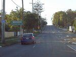
Reassurance Directional Sign:
Northwest along Cavendish Road at Mount Gravatt East, note the RD sign doesn't have a route number on it, however there is a trailblazer on a nearby telegraph pole, March 2006.
Image © Paul Rands
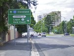
Advance Directional Sign:
AD sign on Vulture St (SR41) approaching Leopard St at Woolloongabba, March 2004.
Image © Michael Greenslade

Advance Directional Sign:
AD sign on Stanley St (SR41) at Woolloongabba approaching Ipswich Rd (SR15) and Main St (SR15), March 2004.
Image © Michael Greenslade

Pacific Motorway Interchange:
ID sign gantry on Stanley St (SR41) at the Pacific Mwy (M3) interchange at Woolloongabba, June 2019. Click or tap here for a photo of this location by Michael Greenslade from March 2004.
Image © Dean Sherry

Pacific Motorway Interchange:
ID sign at the Stanley St (SR41) and Pacific Mwy (then Metroad 3, now M3) interchange at Woolloongabba, March 2004.
Image © Michael Greenslade

Pacific Motorway Interchange:
Freeway green ID sign at the Stanley St (SR41) and Pacific Mwy (then Metroad 3, now M3) interchange at Woolloongabba, March 2004.
Image © Michael Greenslade
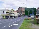
Advance Directional Sign:
AD sign on Stanley St (SR41) approaching Allen St at Woolloongabba, March 2004.
Image © Michael Greenslade

Intersection Directional Sign:
Corner of Creek and Newnham Roads at East Mount Gravatt, October 2010. The coverplate is over an SR20 shield.
Image © Rob Tilley

Intersection Directional Sign:
Corner of Creek and Newnham Roads at East Mount Gravatt, June 2009. The coverplate is over an SR20 shield.
Image © Rob Tilley
1 QLD Government, Department of Transport and Main Roads, from correspondence from April 2012.


