Road Photos & Information: Queensland
Settlement Road, Samford Road, Dawson Parade, Pimelea Street, South Pine Road, Queens Road, Beckett Road, Bridgeman Road, Beams Road, Neville Road, Roghan Road, Carseldine Road, Linkfield Road and Telegraph Road (State Route 40) (Metropolitan Region)
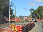
Construction Photos
Statistics:
- Length:
- 21 km
- Termini:
- Northern: Depot Rd (SR22) and Lemke Rd (SR22), Deagon
- Southern: Waterworks Rd (SR31) and Illowra St (unnumbered), The Gap
- Suburbs, Towns & Localities Along Route:
- The Gap, Keperra, Arana Hills, Everton Hills, McDowall, Bridgeman Downs, Bald Hills, Carseldine, Fitzgibbon and Deagon
Route Numbering:
- Current: 40
- Multiplexed with: 22
- Road Authority Internal Classification: 1
- U95 (Keperra)
- 902 (Bald Hills to Carseldine)
General Information:
State Route 40 is a suburban route on Brisbane's northside. It connects several northwestern suburbs with several important routes and passes through residential, commercial and industrial zones.
Multiplexes along the route include:
- State Route 22, for 1 km, Keperra.
History:
- 2011: Widening works along Bridgeman Road at Bridgeman Downs.
This page concentrates on construction photos between The Gap and Deagon
1 QLD Government, Department of Transport and Main Roads, Queensland state-controlled roads and region maps, Metropolitan Region, November 2022.
