Road Photos & Information: Queensland
Ross Street, Currumburra Road, Olsen Avenue, Oxley Drive, Broadwater Avenue and Hope Island Road (State Route 4)
Statistics:
- Length:
- 24 km
- Termini:
- Northern: Pacific Mwy (M1) and Tamborine-Oxenford Rd (SR95), Helensvale
- Southern: Nerang-Broadbeach Rd (SR90) and Birmingham Rd (unnumbered), Carrara
- Suburbs, Towns & Localities Along Route:
- Carrara, Benowa, Ashmore, Southport, Labrador, Biggera Waters, Runaway Bay, Coombabah, Hope Island and Helensvale
Route Numbering:
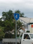
- Current: 4
- Former: 95
- Road Authority Internal Classification: 1
- 114 (Biggera Waters to Helensvale)
- 116 (Carrara to Biggera Waters)
General Information:
State Route 4 is an arterial route in the mid-western suburbs on Queensland's Gold Coast.
A multi-laned divide road, the route services mostly residential and commercial zones. The route acts as by-pass of the main Gold Coast area and feeds suburban traffic to the Pacific Mwy (M1).
History:
- Early 2000s: Renumbering of SR95 east of Pacific Mwy (M1) to SR4.
- September 2008: Completion of duplication of Hope Island Road from Siganto Drive to Gracemere Drive. Installation of new traffic signals at Anaheim Drive and River Links Boulevard. Completions of upgrade of Monterey Keys Drive roundabout to two lanes. Opening of new bridge over Robinsons Creek with pedestrian footpaths on both sides. 2
- January 2009: Work begins on an upgrade of Hope Island Rd and Broadwater Av between Cova Boulevard to Boykambil Esplanade at Hope Island.
- November 2009: Work starts on upgrade work on Oxley Dr between Coombabah Ck and Columbus Dr at Hollywell. 2
- February 2010: Completion of upgrade between Cova Boulevard to Boykambil Esplanade at Hope Island. Works included a new two-lane service road from the new Marina Quays Development to Crescent Avenue that will provide local access, installation of signals at Crescent Avenue and Mervyn Thomas Drive, creation of new cycleways along both sides of the roadway and improved street light and an upgrade the existing roundabout at Helensvale Road. 2
- September 2010: Completion of the Oxley Dr works between Coombabah Ck and Columbus Dr at Hollywell. The upgrade included the construction of an extra lane in each direction and the installation of traffic lights at the junctions with Sunbird Avenue and Matthew Flinders Drive. 2
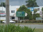
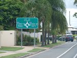
Carrara to Helensvale
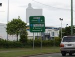
Helensvale to Carrara
1 QLD Government, Department of Transport and Main Roads, Queensland state-controlled roads and region maps, South Coast Region, November 2022.
2 QLD Government, Department of Transport and Main Roads, Projects, Hope Island Road duplication.
2 QLD Government, Department of Transport and Main Roads, Projects, Hope Island Road duplication.


