Statistics:
- Length:
- 53 km
- Termini:
- Eastern: Lytton Road (SR24) and Gosport St, Hemmant
- Western: Ipswich Mwy (M7), Wacol Station Rd (TD3) and Ipswich Mwy Service Rd (unnumbered), Wacol
- Suburbs, Towns & Localities Along Route:
- Wacol, Richlands, Inala, Durack, Willawong, Acacia Ridge, Algester, Calamvale, Sunnybank Hills, Runcorn, Kuraby, Slacks Creek, Springwood, Rochedale South, Rochedale, Mackenzie, Burbank, Chandler, Gumdale, Wakerley, Manly, Wynnum West and Hemmant
Route Numbering:
- Current: 30
- Multiplexed with: 21 22 23 43 13
- Road Authority Internal Classification: 1
- U15 (Algester to Calamvale)
- U91 (Mackenzie to Burbank)
- U98 (Chandler)
General Information:
State Route 30 takes many twists and turns along its path but connects Ipswich, Logan, Redlands and Brisbane council regions, in a sweeping arc across the southeast of greater Brisbane.
Multiplexes along the route include:
- State Route 21, for 600 m, Mackenzie.
- State Route 22, for 2 km, Chandler.
- State Route 23, for 100 m, Wynnum.
- State Route 43, for 800 m, Wakerley.
- National Route 13, for 900 m, Algester.
- Southern Moreton Bay Tourist Drive, for 6 km, between Wakerley and Wynnum West.
History:
- 2011: Widening of Progress Rd (SR30) to 4 lanes between Ipswich Mwy (M2) and Boundary Rd. 1
- April 2011: Construction of new on and off ramps at the Lindum Rd (SR30) and Port of Brisbane Mwy (SR42) junction at Hemmant. 2
- September 2011: Upgrade of the Beaudesert Road (NR13) and Learoyd Road (SR30) intersection at Algester. Works included the provision of a lane for through traffic on Learoyd Rd, bike lane markings, widening of northern and eastern corners of the junction, movement of a traffic signal, relocation of refuge island and the extension of a footpath. 3

Advance Directional Sign:
AD sign at Wacol on the off ramp from Ipswich Mwy (M7), approaching Wacol Station Rd (TD3) and Progress Rd (SR30), March 2012.
Image © Paul Rands

Wacol Station Road:
ID sign at Wacol on the off ramp from Ipswich Mwy (M7), approaching Wacol Station Rd (TD3) and Progress Rd (SR30), March 2012.
Image © Paul Rands

Progress Road:
ID sign at Wacol on the off ramp from Ipswich Mwy (M7), approaching Progress Rd (SR30), March 2012.
Image © Paul Rands
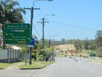
Advance Directional Sign:
AD sign on Inala Av (SR30) approaching Blunder Rd (SR35) at Inala, October 2010. Note the incorrect M4 route number, it should be M2.
Image © Rob Tilley
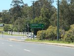
Blunder Road:
Inala Av (SR30) at the Blunder Rd (SR35) junction at Inala, October 2010.
Image © Rob Tilley
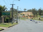
Blunder Road:
Inala Av (SR30) at the Blunder Rd (SR35) junction at Inala, October 2010.
Image © Rob Tilley
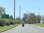
Distance Sign:
RD sign on Inala Av at Durack, October 2010.
Image © Rob Tilley
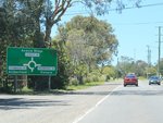
Advance Directional Sign:
AD sign on King Av (SR30) approaching the roundabout with Sherbrooke Rd at Willawong, October 2010.
Image © Rob Tilley
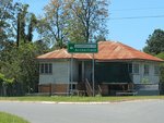
Sherbrooke Road:
Corner of King Av (SR30) and Sherbrooke Rd at Willawong, October 2010.
Image © Rob Tilley
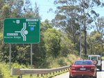
Advance Directional Sign:
AD sign on Learoyd Rd (SR30) approaching Watson Rd at Acacia Ridge, October 2010.
Image © Rob Tilley
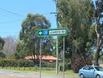
Intersection Directional Sign:
ID sign at the roundabout with Watson Rd in Acacia Ridge, October 2010.
Image © Rob Tilley
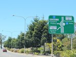
Advance Directional Sign:
AD sign on Learoyd Rd (SR30) at Acacia Ridge approaching Bradman St (SR11) and McCotter St at Acacia Ridge, October 2010.
Image © Rob Tilley
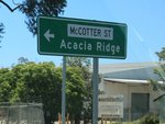
McCotter Street:
ID sign for McCotter St at Acacia Ridge, October 2010.
Image © Rob Tilley
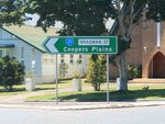
Bradman Street:
ID sign for Bradman St (SR11) at Acacia Ridge, October 2010.
Image © Rob Tilley
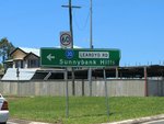
Learoyd Road:
ID sign for Learoyd Rd (SR30) at the roundabout with Bradman St (SR11) and McCotter St in Acacia Ridge, October 2010.
Image © Rob Tilley

Advance Directional Sign:
AD sign on Learoyd Rd (SR30) approaching Beaudesert Rd (NR13) and Hellawell Rd at Algester, October 2010.
Image © Rob Tilley

Beaudesert Road:
Intersection directional sign at the junction of Learoyd Rd (SR30), Hellawell Rd and Beaudesert Rd (NR13) at Algester, October 2010. SR30 turns right at this junction.
Image © Rob Tilley
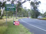
Advance Directional Sign:
AD sign on Old Cleveland Rd (SR30) approaching New Cleveland Rd (SR30) and Old Cleveland Rd (SR44), May 2006. The SR44 for New Cleveland Rd is an error.
Image © Michael Greenslade
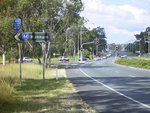
Black Intersection Directional Sign:
Black ID sign on the corner of Old Cleveland Rd (SR30) and Old Cleveland Rd (SR44), May 2006. The SR44 for New Cleveland Rd is an error.
Image © Michael Greenslade
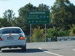
Mt Gravatt-Capalaba Road:
Grieve Rd (SR30) at the junction with Mt Gravatt-Capalaba Rd (SR21) at Mackenzie, June 2009. SR30 turns right at this junction.
Image © Rob Tilley

Advance Directional Sign:
AD sign at Hemmant approaching Inghams Pl and Port of Brisbane Mwy (SR42), July 2010.
Image © Rob Tilley

Port Of Brisbane Motorway:
Lindum Rd (SR30) at the Port of Brisbane Mwy (SR42) interchange at Hemmant, July 2010.
Image © Rob Tilley
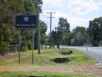
Black Reassurance Directional Sign:
Black distance sign on New Cleveland Rd at Chandler, May 2006. This sign has since been removed.
Image © Michael Greenslade
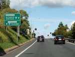
Advance Directional Sign:
AD sign on the off-ramp from Pacific Mwy (M1) at Rochedale, June 2009.
Image © Rob Tilley
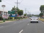
Reassurance Directional Sign:
RD sign on Compton Rd (SR30) at Woodridge, March 2010.
Image © Rob Tilley
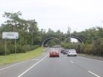
Wildlife Crossing:
Wildlife crossing over Compton Rd (SR30) at Kuraby near Karawatha Forest, March 2010.
Image © Rob Tilley
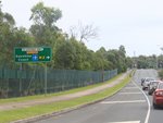
Supplemental Advance Directional Sign:
Supplemental AD sign on Compton Rd (SR3) at Kuraby approaching Persse Rd, March 2010.
Image © Rob Tilley
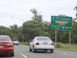
Advance Directional Sign:
AD sign on Compton Rd (SR3) at Kuraby approaching Persse Rd, March 2010.
Image © Rob Tilley

Advance Directional Sign:
AD sign on Compton Rd (SR30) approaching Calam Rd (SR36) at Runcorn, March 2010.
Image © Rob Tilley
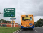
Advance Directional Sign:
AD sign on Compton Rd (SR30) approaching Beaudesert Rd (NR13) at Calamvale, March 2010. SR30 turns right at this junction and duplexes with NR13.
Image © Rob Tilley
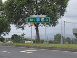
Intersection Directional Sign:
ID sign on Compton Rd (SR30) at the junction with Beaudesert Rd (NR13) at Calamvale, March 2010. SR30 turns right at this junction and duplexes with NR13.
Image © Rob Tilley

Advance Directional Sign:
AD sign on Progress Rd (SR30) approaching the interchange with Ipswich Mwy (M7) and Wacol Stn Rd (TD3), March 2012.
Image © Paul Rands

Ipswich Motorway & Wacol Station Road:
Progress Rd (SR30) at the interchange with Ipswich Mwy (M7) and Wacol Stn Rd (TD3), March 2012.
Image © Paul Rands
1 QLD Government, Department of Transport and Main Roads, Metropolitan Road Region Map, November 2022.
2 Brisbane City Council, Progress Road upgrade stage 2, Community Newsletter, May 2011.
3 QLD Government, Department of Transport and Main Roads, Projects, PortConnect Project Overview.
4 QLD Government, Department of Transport and Main Roads, Projects, Beaudesert Road and Learoyd Road intersection improvement works.


