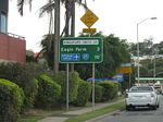
Road Photos & Information: Queensland
Wickham Street, Ann Street, Breakfast Creek Road, Kingsford Smith Drive, Eagle Farm Road, Main Myrtletown Road, Priors Road, Bancroft Road, Brownlee Street and Main Beach Road (State Route 25) (Metropolitan Region)
Statistics:
- Length:
- 16 km
- Termini:
- Eastern: Marine Rd (unnumbered), Pinkenba
- Western: Gipps St (SR15) and Wickham St (unnumbered) and Gipps St (SR15), Kemp Pl (SR15) and Ann St (unnumbered), Fortitude Valley (one-way pair)
- Suburbs, Towns & Localities Along Route:
- Fortitude Valley, Newstead, Albion, Hamilton, Eagle Farm and Pinkenba
Route Numbering:
- Current: 25
General Information:
State Route 25 is an arterial route linking the Brisbane CBD with the industrial suburbs and airport east of the city.
The route is a mix of divided and undivided road, which features a one-way pair in Fortitude Valley, and also travels along the foreshore of Brisbane River through the Hamilton area.
History:
- 1829-1830: Kingsford Smith Drive was built by convict labour and connected Brisbane town with the women's jail at Eagle Farm. 1
Fortitude Valley to Pinkenba
Pinkenba to Fortitude Valley
1 QLD Government, State Library of Queensland, Early view of Hamilton, Brisbane, 1868.


