Road Photos & Information: Queensland
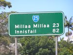
Atherton-Malanda Road, Malanda-Atherton Road, Millaa Millaa-Malanda Road and Palmerston Highway (State Route 25) (Far North Region)
Statistics:
- Length:
- 94 km
- Termini:
- Eastern: Bruce Hwy (A1), Goondi
- Western: Kennedy Hwy (NR1), Atherton
- Suburbs, Towns & Localities Along Route:
- Atherton, East Barron, Upper Barron, Kureen, Malanda, Jaggan, Tarzali, Minbun, Moregatta, Millaa Millaa, Ellinjaa, Mungalli, Wooroonooran, East Palmerston, Nerada, Cooruma, Pin Gin Hill, Stoters Hill, O'Briens Hill, Belvedere and Goondi
Route Numbering:
- Current: 25
- Multiplexed with:
- Road Authority Internal Classification: 1
- 21A (Millaa Millaa to Goondi)
- 641 (Malanda to Millaa Millaa)
- 645 (Atherton to Malanda)
General Information:
State Route 25, in far north Queensland, is a connector route linking the Atherton tablelands with the east coast town of Innisfail.
A windy undivided two-laned road, it passes through lush rainforest and semi-rural properties.
Multiplexes along the route include:
- Great Tropical Drive, for 94 km between Atherton and Goondi. 2
History:
- 2010: Upgrade of the intersection at East Evelyn Road and Millaa Millaa-Malanda Road (SR25) at Millaa Millaa. Work included widening, construction of turning lanes, flashing warning signs and lighting. 3
Atherton to Goondi
1 QLD Government, Department of Transport and Main Roads, Queensland State Controlled Roads and Regions Maps, Far North Region, November 2022.
2 Great Tropical Drive - A New Discovery Around Every Corner brochure, 23 April 2009.
3 QLD Government, Media Statements, Safety Upgrade for East Evelyn Intersection, 21 October 2010.
2 Great Tropical Drive - A New Discovery Around Every Corner brochure, 23 April 2009.
3 QLD Government, Media Statements, Safety Upgrade for East Evelyn Intersection, 21 October 2010.


