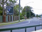
Road Photos & Information: Queensland
Ashmore Road, Salerno Street and Via Roma (State Route 24) (South Coast Region)
Statistics:
- Length:
- 8 km
- Termini:
- Eastern: Gold Coast Hwy (Remembrance Dr) (SR2), Surfers Paradise
- Western: Southport-Nerang Rd (SR20) and Ashmore Rd (unnumbered), Ashmore
- Suburbs, Towns & Localities Along Route:
- Ashmore, Benowa, Bundall and Surfers Paradise
Route Numbering:
- Current: 24
General Information:
State Route 24 is located on the Gold Coast, in Queensland's southeast. It is mostly divided and services residential and commercial areas.
History:
- 14 December 2017: The nation's first Continuous Flow Intersection (CFI) has opened at the corner of Bundall Road (SR3) and Salerno Street (SR24). The introduction of the CFI created two new right-hand turn lanes, into Salerno Street. 1
- 2019: Work commences on replacing Isle of Capri Bridge, which was constructed in 1959. 2
Ashmore to Surfers Paradise
1 QLD Government, Queensland Cabinet, and Ministerial Directory, Media Statements, Australian first now open to traffic on Southport–Burleigh Road, 14 December 2017.
2 City of Gold Coast, Isle of Capri Decongestion Project.
2 City of Gold Coast, Isle of Capri Decongestion Project.

