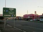
Road Photos & Information: Queensland
Charters Towers Road, Bowen Road and Stuart Drive (State Route 17)
Statistics:
- Length:
- 10 km
- Termini:
- Northern: Woolcock Street (SR14), Boundary Street (SR14) and Charters Towers Rd (unnumbered), Hyde Park
- Southern: Bruce Hwy (A1) and Stuart Dr (unnumbered), Idalia
- Miscellaneous:
- Declared Names: Townsville Connection Road
- Suburbs, Towns & Localities Along Route:
- Annandale, Idalia, Mundingburra, Mysterton, Rosslea and Hermit Park
Route Numbering:
- Current: 17
- Former: 1 1 1
- Road Authority Internal Classification: 1
- 830
General Information:
State Route 17 serves as a important arterial road in Townsville, situated on Queensland's north coast. This route, which historically was a segment of the Bruce Highway, now connects the Townsville CBD with the Bruce Highway (A1) and eventually to the Flinders Highway (A6). State Route 17 comprises a combination of divided and undivided roadways.
History:
- 1974: National Route 1 replaced by National Highway 1.
Annandale to Hermit Park
1 QLD Government, Department of Transport and Main Roads, Northern Region Map, November 2022.


