Statistics:
- Length:
- 6 km
- Termini:
- Northern: Inner City Bypass (M3), Clem Jones Tunnel (M7) and Lutwyche Rd, Windsor
- Southern: Clem Jones Tunnel (M7) and Ipswich Rd (A7), Woolloongabba
- Suburbs, Towns & Localities Along Route:
- Woolloongabba, Kangaroo Point, Fortitude Valley, Spring Hill, Herston and Windsor
Route Numbering:
- Current: 15
- Former: 1 1 15
General Information:
State Route 15 is a key suburban arterial road in the Brisbane metropolitan area. Historically, the roads that make up this route were once among the most important in Brisbane. The route passes the Brisbane CBD to the south, east, and north, and features a combination of divided and undivided sections.
The route features the Story Bridge over the Brisbane River, which connects Kangaroo Point and Fortitude Valley together. The Story Bridge was designed by Dr JCC Bradfield, who was responsible for the Sydney Harbour Bridge. The Story Bridge was modelled after the Jacques Cartier Bridge in Montreal, Canada. The construction of the bridge was undertaken by Queensland companies Evans, Deakin and Co. and Hornibrook Constructions, with the majority of the materials manufactured within Australia and most of the works conducted within Queensland. The bridge was named after Public Service Commissioner, JD Story, with the highway named after the designer, Bradfield. 1
History:
- 24 May 1935: Construction begins with a sod turning ceremony for the Story Bridge over Brisbane River. The ceremony was led by William Forgan (Bill) Smith, the then premier of Queensland. 1
- 6 July 1940: Story Bridge opened to traffic. 1
- 1993: State Route 20 duplex discontinued on Ipswich Road, between Sherwood Road and Granard Road.
- 1994: National Route 15 designation revoked. It was to be replaced with ALT-NR15, however the route became SR15 as a result of an allocation of state routes by Brisbane City Council. 2
- 2010: State Route 15 truncated south of Pacific Mwy (former South East Fwy) (M3) overpass at Woolloongabba and replaced with A7 to coincide with the opening of Clem Jones Tunnel (M7).
Click or tap here for the former alignment between Rocklea and Woolloongabba

Advance Directional Sign:
AD sign on Ipswich Rd (SR15) approaching Stanley St (SR41) at Woolloongabba, September 2009.
Image © Rob Tilley

Stanley Street:
Corner of Ipswich Rd (SR15) and Stanley St (SR41) at Woolloongabba, September 2009. SR15 becomes Main St from this junction.
Image © Rob Tilley

Advance Directional Sign:
AD sign on Main St (SR15) approaching Vulture St (SR41) at Woolloongabba, September 2009.
Image © Rob Tilley

Intersection Directional Sign:
ID sign near the junction with Vulture St (SR41) at Woolloongabba, September 2009.
Image © Rob Tilley

Advance Directional Sign:
AD signs on the Shafston Av (SR23) bridge at Kangaroo Point, September 2009. SR15 becomes Bradfield Hwy at this interchange.
Image © Rob Tilley

Advance Directional Sign:
AD sign at the Shafston Av (SR23) interchange at Kangaroo Point, September 2009.
Image © Rob Tilley

Story Bridge:
Southern approach to the Story Bridge from the pedestrian deck, October 2005.
Image © Paul Rands

Story Bridge:
Looking northbound along Story Bridge over Brisbane River at Kangaroo Point, September 2009.
Image © Rob Tilley

Story Bridge:
Looking northbound along Story Bridge over Brisbane River at Kangaroo Point, October 2005.
Image © Paul Rands

Advance Directional Sign:
Bradfield Hwy (SR15) at Kangaroo Point approaching Ann St (SR25), September 2009.
Image © Rob Tilley

Dedication Plaque:
Dedication plaque on the Story Bridge on the pedestrian deck in Fortitude Valley, October 2005.
Image © Paul Rands

Ann Street:
ID sign at the junction of Kemp Pl (SR15) and Ann St in Fortitude Valley, September 2009. SR15 becomes Gipps St at this junction.
Image © Rob Tilley

Intersection Directional Sign:
ID sign on Ann St at the junction with Gipps St (SR15) and Kemp Pl (SR15) at Foritude Valley, October 2005.
Image © Paul Rands

Advance Directional Sign:
AD sign on Gipps St (SR15) approaching Wickham St (SR25) at Fortitude Valley, September 2009.
Image © Rob Tilley

Advance Directional Sign:
AD sign on Gipps St (SR15) approaching Barry Pde (SR15) and St Pauls Tce at Fortitude Valley, October 2005.
Image © Paul Rands

Advance Directional Sign:
AD sign on Barry Pde (SR15) approaching St Pauls Tce at Fortitude Valley, September 2009.
Image © Rob Tilley

Advance Directional Sign:
AD sign on Bowen Bridge Rd (SR15) approaching Herston Rd, September 2009. SR15 ends 1 km beyond this point at the junction with Lutwyche Rd (A3), Inner City Bypass (M3) and Clem Jones Tunnel (M7).
Image © Rob Tilley
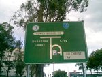
Advance Directional Sign:
AD sign on Herston Rd at Herston approaching Bowen Bridge Rd (SR15), October 2007.
Image © Paul Rands

Advance Directional Sign:
AD sign on O'Connell Tce approaching Bowen Bridge Rd (SR15) at Fortitude Valley, May 2018.
Image © Rob Tilley
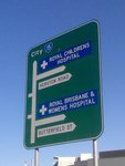
Advance Directional Sign:
AD sign on Bowen Bridge Rd (SR15) at Herston approaching Butterfield St and Herston Rd, August 2007.
Image © Paul Rands

Advance Directional Sign:
AD sign on Bowen Bridge Rd (SR15) at Herston approaching Herston Rd, May 2018. Click or tap here for a photo of this location by Rob Tilley from September 2009.
Image © Rob Tilley

Advance Directional Sign:
AD sign on Bowen Bridge Rd (SR15) at Fortitude Valley approaching Gregory Tce (SR10), May 2018.
Image © Rob Tilley

Advance Directional Sign:
AD sign on Brunswick St (SR15) approaching Water St in Fortitude Valley, September 2009.
Image © Rob Tilley

Advance Directional Sign:
AD sign on Brunswick St (SR15) approaching Barry Pde (SR15) and St Pauls Tce (SR26) at Fortidude Valley, September 2009. Note the remnant Metroad 3 shield on the truck route sign. Metroad 3 has been replaced by M3.
Image © Rob Tilley

Advance Directional Sign:
AD sign on Barry Pde (SR15) approaching the unnumbered section of Barry Pde and Gipps St (SR15) at Fortidude Valley, September 2009. Note the remnant Metroad 3 shield on the truck route sign. Metroad 3 has been replaced by M3.
Image © Rob Tilley

Trailblazer:
SR15 trailblazer on Gipps St (SR15) at the junction with Ann St and Kemp Pl (SR15) at Fortitude Valley, September 2009.
Image © Rob Tilley
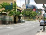
Advance Directional Sign:
AD sign on Ann St approaching Gipps St (SR15) and Kemp Pl (SR15) at Foritude Valley, October 2005.
Image © Paul Rands

Intersection Directional Sign:
AD style sign acting as an ID sign on the onramp to Story Bridge at Fortitude Valley, March 2012.
Image © Paul Rands

Story Bridge:
Story Bridge over Brisbane River, Fortitude Valley, March 2004.
Image © Michael Greenslade

Dedication Plaque:
Dedication plaque on the Story Bridge on the pedestrian deck in Fortitude Valley, October 2005.
Image © Paul Rands

Story Bridge:
Looking southbound along Story Bridge over Brisbane River at Fortitude Valley, September 2009.
Image © Rob Tilley

Advance Directional Sign:
AD sign on Bradfield Hwy (SR15) approaching Main St (SR15) and Shafston Av (SR23) at Kangaroo Point, September 2009. Click or tap here for a photo of this location by Paul Rands from October 2005.
Image © Rob Tilley

Changeable Sign:
Changeable sign on Bradfield Hwy (SR15) at Kangaroo Point, September 2009.
Image © Rob Tilley

Advance Directional Sign:
AD sign on Bradfield Hwy (SR15) approaching Shafston Av (SR23) at Kangaroo Point, September 2009.
Image © Rob Tilley
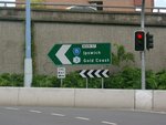
Intersection Directional Sign:
ID sign facing Cairns St in Kangaroo Point, October 2005.
Image © Paul Rands

Shafston Avenue Interchange:
Bradfield Hwy (SR15) at the interchange with Main St (SR15) and Shafston Av (SR23) at Kangaroo Point, September 2009.
Image © Rob Tilley
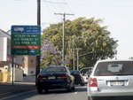
Supplemental Advance Directional Sign:
Supplemental AD sign approaching River Tce at Kangaroo Point, September 2009.
Image © Rob Tilley
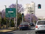
Distance Sign:
Reassurance directional sign on Main St (SR15) near Peaston St at Kangaroo Point, September 2009.
Image © Rob Tilley

Advance Directional Sign:
AD sign on Main St (SR15) at Kangaroo Point approaching Vulture St (SR41), September 2009.
Image © Rob Tilley

Advance Directional Sign:
AD sign on Ipswich Road (SR15) approaching Vulture and Stanley Streets (SR41) at Woolloongabba, September 2009. Click or tap here for a photo of this location by Paul Rands from October 2005.
Image © Rob Tilley

Freeway Green Sign:
Freeway green sign with access times to southbound lanes of Pacific Mwy (M3) approaching Stanley St (SR41) at Woolloongabba, September 2009.
Image © Rob Tilley
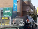
Distance Sign:
RD sign on Ipswich Rd (SR15) at Woolloongabba, September 2009.
Image © Rob Tilley

Advance Directional Sign:
AD sign near Pacific Mwy (M3) at the SR15 terminus approaching O'Keefe St and the A7 section of Ipswich Rd at Woolloongabba, September 2009.
Image © Rob Tilley
1 QLD Government, Queensland Museum, Collection Database, Opening Ribbon for the Story Bridge.
2 QLD Government, Transport and Main Roads, from correspondence from April 2012.


