Statistics:
- Length:
- 7 km
- Termini:
- Eastern: Gold Coast Hwy (Marine Pde) (SR2) and Mitchell Park entrance, Southport
- Western: Pacific Mwy (M1) and Smith St (unnumbered), Gaven
- Suburbs, Towns & Localities Along Route:
- Gaven, Molendinar and Southport
Route Numbering:
- Current: 10
- Former: 86
- Road Authority Internal Classification: 1
- 101
General Information:
State Route 10 on Queensland's Gold Coast is a short limited access road and arterial road linking Southport with the Pacific Motorway (M1).
The eastern end of the route is suburban arterial road, whilst the western end is motorway standard, albeit quite short.
The route services Griffith University, Gold Coast Campus and Parklands Gold Coast, the city's showgrounds and the Gold Coast University Hospital.
History:
- May 1996: State Route 86 route number replaced with State Route 10, as part of the Main Roads Route Marking Review of January 1996. 2
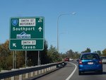
Advance Directional Sign:
AD sign at Gaven approaching the unnumbered section of Smith Street, August 2009.
Image © Rob Tilley
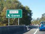
Smith Street:
Eastbound at the Smith St interchange at Gaven, August 2009.
Image © Rob Tilley

Advance Directional Sign:
AD sign on Smith St Mwy (SR10) at Parkwood approaching Olsen Av (SR4), August 2009.
Image © Rob Tilley

Olsen Street:
Intersection directional sign on Smith St Mwy (SR4) at the Olsen St interchange at Parkwood, August 2009. The motorway conditions end 600 m after this interchange.
Image © Rob Tilley

Advance Directional Sign:
AD sign approaching Scarborough St in Southport, June 2012.
Image © Justin Cozart

Intersection Directional Sign:
ID sign on the corner of North St (SR10) and Scarborough St in Southport, June 2012.
Image © Justin Cozart

Advance Directional Sign:
AD sign at Southport approaching High St (SR3), July 2018.
Image © Rob Tilley

Advance Directional Sign:
AD sign on Smith St (SR10) at Southport approaching Kumbari Av, March 2005. This sign has since been removed.
Image © Michael Greenslade

Intersection Directional Sign:
ID sign at the corner of North St (SR10) and High St (SR3) in Southport, June 2012.
Image © Justin Cozart
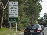
Start Motorway:
Prohibition sign at the beginning of the Smith Street Motorway (SR10) at Southport, June 2012.
Image © Justin Cozart

Advance Directional Sign:
AD sign at Southport approaching the at-grade junction with Parklands Dr, July 2018. Click or tap here for a photo of this location by Justin Cozart from June 2012.
Image © Rob Tilley

Supplemental Advance Directional Sign:
Supplemental AD sign approaching Parklands Dr at Southport, July 2018.
Image © Rob Tilley

Advance Directional Sign:
AD sign at Southport approaching the interchange with Olsen Av (SR4), June 2012.
Image © Justin Cozart

Advance Directional Sign:
AD sign at Southport approaching the interchange with Olsen Av (SR4), July 2018. Click or tap here for a photo of this location by Justin Cozart from June 2012.
Image © Rob Tilley

Advance Directional Sign:
AD sign approaching Olsen Av (SR4) at Southport, July 2018.
Image © Rob Tilley

Olsen Avenue Interchange:
Smith St Mwy (SR10) at the Olsen St interchange at Southport, July 2018. Click or tap here for a photo of this location by Justin Cozart from June 2012.
Image © Rob Tilley
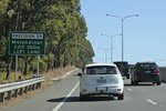
Advance Directional Sign:
Supplemental AD sign at Molendinar approaching Precision Dr, July 2018.
Image © Rob Tilley

Supplemental Advance Directional Sign:
Supplemental AD sign at Molendinar approaching Precision Dr, July 2018.
Image © Rob Tilley
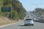
Precision Drive Interchange:
Smith St Mwy (SR10) at the Precision Dr interchange at Molendinar, July 2018.
Image © Rob Tilley

Advance Directional Sign:
AD sign at Molendinar approaching the Pacific Mwy (M1) interchange, July 2018. Click or tap here for a photo of this location from June 2012.
Image © Rob Tilley

Advance Directional Sign:
AD sign at Molendinar approaching the Pacific Mwy (M1) interchange, July 2018.
Image © Rob Tilley

Supplemental Advance Directional Sign:
Supplemental AD sign at Molendinar approaching the Pacific Mwy (M1) interchange, July 2018.
Image © Rob Tilley

Pacific Motorway Interchange:
Smith St Mwy (SR10) at the Pacific Mwy (M1) interchange at Molendinar, July 2018.
Image © Rob Tilley
1 QLD Government, Department of Transport and Main Roads, Queensland state-controlled roads and region maps, South Coast Region, November 2022.
2 QLD Government, Transport and Main Roads, Head Office Mapping Section, via email correspondence.


