Road Photos & Information: Queensland
Nambour-Bli Bli Road (State Route 10) (North Coast Region)
Statistics:
- Length:
- 7 km
- Termini:
- Eastern: David Low Way (SR6), Bli Bli
- Western: Bruce Hwy (M1) and Bli Bli Rd (TD23), Nambour
- Suburbs, Towns & Localities Along Route:
- Nambour and Bli Bli
Route Numbering:
- Current: 10
- Road Authority Internal Classification: 1
- 130
General Information:
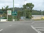
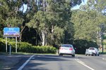
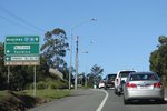
State Route 10 on Queensland's Sunshine Coast is a short semi-rural route connecting Nambour and the Bruce Hwy (M1) with the Maroochydore area. The route is undivided for most of its length.
Nambour to Bli Bli
1 QLD Government, Department of Transport and Main Roads, Queensland state-controlled roads and region maps, North Coast Region, November 2022.


