Road Photos & Information: Queensland
Carnarvon Highway (National Route 46)
Statistics:
- Length:
- 111 km
- Termini:
- Northern: Castlreagh Hwy (A55) and Carnarvon Hwy (A55), St George
- Southern: QLD-NSW Border, Mungindi
- Suburbs, Towns & Localities Along Route:
- Mungindi, Thallon, Nindigully and St George
Route Numbering:
- Current: 46
- Road Authority Internal Classification: 1
- 24A
General Information:
National Route 46 is a key route in Queensland's southwestern border region, connecting the town of St George to the NSW border and eventually Moree in NSW.
The route, which forms part of the shortest route between Sydney and Darwin, is rural highway standard, and services a handful of small towns and localities. The route also passes through one of only a handful of towns in Australia, dissected in two by a state border, Mungindi.
History:
- 2010: Replacement of single-lane timber bridge over Barwon River at Mungindi.
NSW Border to St George
St George to NSW Border

Advance Directional Sign:
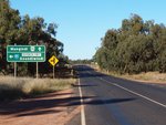
AD sign at Nindigully approaching Barwon Hwy (SR85), June 2012. Click or tap here for a photo of this location by Paul Rands from October 2005.
Image © Peter Renshaw
1 QLD Government, Department of Transport and Main Roads, Queensland state-controlled roads and region maps, South West Region, November 2022.


