Road Photos & Information: Queensland
Pacific Highway (National Route 1)
New South Wales Border to Tugun
Former Alignment
Statistics:
- Length:
- 6 km
- Termini:
- Northern: Pacific Mwy (M1) and Stewart Rd (unnumbered), Tugun
- Southern: NSW-QLD Border, Tugun
- Miscellaneous:
- Continued as Pacific Hwy (NR1) in New South Wales
- Suburbs, Towns & Localities Along Route:
- Bilinga, Tugun and Currumbin Waters
Route Numbering:
- Current: 2
- Former: 1
- Road Authority Internal Classification: 1
- 11B
General Information:
National Route 1 formed part of the main coastal route between Victoria and Queensland. The route featured a mix of rural highway, arterial and freeway design standards. The route formed part of what is collectively known as Highway 1. It was Australia's coastal highway joining all mainland's state capitals and coastal towns circumnavigating the entire Australian continent. It is also the longest numbered highway in the world, covering more than 14 500 km. National Route 1 is still in service in segments in Queensland and Western Australia. Many of the National Route 1 alignments outside the remaining active sections have been renumbered, mostly to alphanumeric designations.
The Pacific Highway once traversed the heart of the Gold Coast CBD, but once bypasses were completed to the west of the populated areas of the Gold Coast, the original Pacific Highway was renamed Gold Coast Highway between the Tugun and Helensvale and the bypasses became the Pacific Highway. The alignment of National Route 1 between Musgrave Street, Bilinga and Stewart Road, Tugun is built over the old South Coast Railway line alignment, which was closed in 1961.
The route is a mix of divided and undivided urban highway and passes through light industrial areas, as well as commercial, residential and tourist areas.
History:
- December 1930: The main South Coast Road, which had originally been built as a series of small roads linking the dairying and sugar farms south of Brisbane to the main railway line, became the Pacific Highway. 2
- 01 July 1961: The South Coast Railway closed between Nerang and Tweed Heads. 3 Some of this old railway alignment was later used for a new alignment of the Pacific Highway between Bilinga and Tugun.
- 17 May 1985: Palm Beach to Tugun Extension. 4
- 18 July 1985: Tweed Heads Bypass opened to traffic, bypassing Coolangatta in QLD and Tweed Heads in NSW. The two-lane bypass opened by Minister for Main Roads and Racing Russ Hinze, at a total cost of $3.6 million. 5
- December 1986: The second carriageway of the Tweed Heads Bypass completed. 5
- August 1997: Reedy Creek to Tugun Duplication. 6
- February 2007: Completion of tunnel excavation for Tugun Bypass. 7
- 2008: Completion of Tugun Bypass. 8 National Route 1 was then replaced by State Route 2 between Bilinga and Tugun.
This page concentrates on the former alignment between the NSW Border and Tugun
Click or tap here for the former alignment between the NSW Border and Bilinga via Coolangatta Town Centre
Map Key: Blue Line = Pre-1980s Alignment. Purple Line = Pre-1985 Alignment. Orange Line = Final NR1 Alignment.
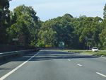
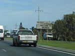
NSW Border to Tugun
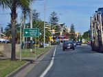
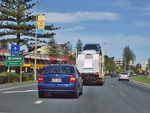
Tugun to NSW Border

Intersection Directional Sign:
ID sign at the junction with Gold Coast Hwy (SR2), Tugun, February 2009. NR1 turns right at this location.. Click or tap here for a photo of this location by Paul Rands from March 2006.
Image © Rob Tilley
2 QLD Government, Department of Transport and Main Roads, Bulldust, Beef and Beyond.
3 QLD Government, Queensland Rail, Our History, The Queensland Rail Journey, History Podcast - Episode 15.
4 QLD Government, Department of Transport and Main Roads, Annual Report 1984-1985.
5 QLD Government, Department of Transport and Main Roads, Queensland Roads, July 1987.
6 QLD Government, Department of Transport and Main Roads, Annual Report 1995-1996.
7 QLD Government, Department of Transport and Main Roads, Pacific Motorway Upgrade Stage 1 Nerang - Varsity Lakes, April 2007.
8 Courier Mail, Tugun bypass opens - finally, 3 June 2008.
