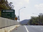
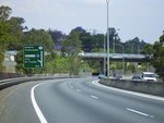
Statistics:

Length:
19 km
Termini:
Northern: Miskin St (unnumbered), Milton Rd (SR32) and Frederick St (Metroad 5), Toowong
Southern: Logan Mwy (Metroad 4) and Centenary Hwy (unnumbered), Forest Lake
Suburbs, Towns & Localities Along Route:
Forest Lake, Ellen Grove, Richlands, Darra, Sumner, Mt Ommaney, Seventeen Mile Rocks, Jindalee, Sinnamon Park, Kenmore, Fig Tree Pocket, Indooroopilly, Mt Coot-tha and Toowong

Route Numbering:

Current: M5
Former: 5 32 67
Road Authority Internal Classification: 1
U18A (Forest Lake to Jindalee)
U18B (Jindalee to Toowong)

General Information:

The section of Metroad 5 between Forest Lake and Toowong is a freeway standard route and the Western Freeway section was the first freeway route to be constructed in Brisbane.

The route services mostly residential and commercial zones and links the northern suburbs with the city's southern and western suburbs.

History:

1969: Western Freeway opened to traffic. 2
1995: Metroad 5 route number introduced, SR32 decommissioned along between Forest Lake and Toowong. 3
October 2006: Metroad 5 replaced by M5 between Forest Lake and Toowong. 4

This page concentrates on the former alignment between Forest Lake and Toowong

Darra to Toowong

image

Logan Motorway:

Centenary Hwy (unnumbered) at the Logan Mwy (Metroad 4) and Centenary Hwy (Metroad 5) interchange at Carole Park, October 2004. Note the incorrect route number shield colours.

Image © Michael Greenslade

image

Centenary Highway Off Ramp:

Darra Interchange with Ipswich Mwy (Metroad 2), March 2006.

Image © Paul Rands

image

Centenary Highway Off Ramp:

Darra Interchange with Ipswich Mwy (Metroad 2), March 2006.

Image © Paul Rands

image

Centenary Highway Off Ramp:

Darra Interchange with Ipswich Mwy (Metroad 2), March 2006.

Image © Paul Rands

image

Traffic Report Sign:

Sign showing the number of traffic reports at Sumner. March 2006, northbound.

Image © Paul Rands

image

Freeway Green Signage:

Advance directional sign for the Glen Ross Rd / Dandenong Rd interchange at Mt Ommaney. March 2006, northbound.

Image © Paul Rands

image

Freeway Green Signage:

Advance directional sign at Jindalee for the Sinnamon Road and Seventeen Mile Rocks Road interchange. March 2006, northbound.

Image © Paul Rands

image

Brisbane River:

Centenary Bridge over the Brisbane River at Jindalee. March 2006.

Image © Paul Rands

image

Freeway Green Signage:

Advance directional sign for the Jindalee and Sinnamon Park interchange (Seventeen Mile Rocks Road). March 2006, northbound.

Image © Paul Rands

image

Advance Directional Signage:

AD sign for the Figtree Pocket Road and Moggill Road (SR33) interchanges. March 2006, northbound at Indooroopilly.

Image © Paul Rands

image

Advance Directional Sign:

AD sign for the Moggill Road interchange. March 2006, northbound at Indooroopilly. Centenary Highway becomes the Western Freeway at this interchange.

Image © Paul Rands

image

Distance Sign:

Northbound RD sign, located after the Moggill Road interchange at Indooroopilly, March 2006.

Image © Paul Rands

image

End of the Western Freeway:

Northbound at Toowong as you approach Mt Coot-tha Road (TD7 and Metroad 5) roundabout, March 2006.

Image © Paul Rands

image

Advance Directional Sign:

AD sign at Mt Coot-tha on Mt Coot-tha Rd (TD7) approaching Western Fwy (Metroad 5), October 2004.

Image © Michael Greenslade

Toowong to Darra

image

Advance Directional Sign:

AD sign on Frederick St (Metroad 5) approaching Milton Rd (SR32) and Western Fwy (Metroad 5) at Toowong, October 2004.

Image © Michael Greenslade

image

Slip Lane:

Slip lane from Frederick St (Metroad 5) onto Western Fwy (Metroad 5) at Toowong, October 2004.

Image © Michael Greenslade

image

Western Freeway On Ramp:

Slip lane from Frederick St (Metroad 5) onto Western Fwy (Metroad 5) approaching Dean St and Mt Coot-tha Rd (TD7) at Toowong, October 2004.

Image © Michael Greenslade

image

Reassurance Directional Sign:

Distance sign at Toowong, October 2004.

Image © Michael Greenslade

image

Moggill Road Exit Sign:

AD sign at Taringa for the Moggill Rd (SR33) exit and also where the freeway changes to Centenary Hwy. October 2004.

Image © Michael Greenslade

image

Centenary Highway:

View of the Centenary Hwy (Metroad 5) from Kenmore Rd overpass at Figtree Pocket, October 2004. Note the freeway green AD sign for Sinnamon Rd interchange.

Image © Michael Greenslade

image

Advance Directional Sign:

AD sign at Sinnamon Park approaching Sumners Rd interchange, October 2004.

Image © Michael Greenslade

image

End Of Freeway Conditions 1 km:

Sign indicating end of grade-separated road at Darra, approaching Ipswich Mwy (Metroad 2), October 2004.

Image © Michael Greenslade

image

Advance Directional Sign:

AD sign at Darra approaching Ipswich Mwy (Metroad 2), October 2004.

Image © Michael Greenslade

image

Advance Directional Sign:

AD sign at Darra approaching Ipswich Mwy (Metroad 2), October 2004.

Image © Michael Greenslade

image

Reassurance Directional Sign:

Distance sign on Centenary Hwy (Metroad 5) at Richlands after Ipswich Mwy (Metroad 2), October 2004.

Image © Michael Greenslade

image

Advance Directional Sign:

AD sign at Richlands approaching Progress Rd (SR30), October 2004.

Image © Michael Greenslade

1 QLD Government, Department of Transport and Main Roads, Queensland State Road Network Map, 30 June 2008.
2 Sam Laybutt (Ozroads).
3 Lachlan Sims.
4 Michael Greenslade.